Approximate Location Map
Large Map »
Latitude: 51.2846 / 51°17'4"N
Longitude: 1.0702 / 1°4'12"E
OS Eastings: 614197
OS Northings: 158413
OS Grid: TR141584
Mapcode National: GBR TY2.FD4
Mapcode Global: VHLGF.HZN4
Plus Code: 9F3373MC+R3
Entry Name: 22, Whitstable Road
Listing Date: 7 September 1973
Grade: II
Source: Historic England
Source ID: 1242879
English Heritage Legacy ID: 443894
ID on this website: 101242879
Location: St Dunstan's, Canterbury, Kent, CT2
County: Kent
District: Canterbury
Electoral Ward/Division: St Stephen's
Parish: Non Civil Parish
Built-Up Area: Canterbury
Traditional County: Kent
Lieutenancy Area (Ceremonial County): Kent
Tagged with: Building
1.
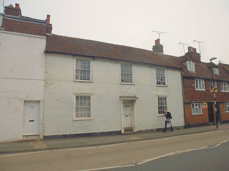
944 WHITSTABLE ROAD
(East Side)
No 22
TR 1458 SW 1/314
II GV
2.
C18. 2 storeys painted brick. Tiled roof. 3 sashes with verticals only.
Central doorcase with weatherhood on brackets and 2 steps. Restored doorcase.
Nos 12 to 24 (even) form a group.
Listing NGR: TR1419758413
External links are from the relevant listing authority and, where applicable, Wikidata. Wikidata IDs may be related buildings as well as this specific building. If you want to add or update a link, you will need to do so by editing the Wikidata entry.


Other nearby listed buildings
