Latitude: 53.2934 / 53°17'36"N
Longitude: -2.5039 / 2°30'14"W
OS Eastings: 366509
OS Northings: 377498
OS Grid: SJ665774
Mapcode National: GBR BZYC.Q4
Mapcode Global: WH995.HHW2
Plus Code: 9C5V7FVW+9C
Entry Name: Churchyard Wall to High Street, School Lane and Southbank
Listing Date: 27 August 1986
Grade: II
Source: Historic England
Source ID: 1087075
English Heritage Legacy ID: 57541
ID on this website: 101087075
Location: St Mary and All Saints Church, Great Budworth, Cheshire West and Chester, Cheshire, CW9
County: Cheshire West and Chester
Civil Parish: Great Budworth
Traditional County: Cheshire
Lieutenancy Area (Ceremonial County): Cheshire
Church of England Parish: Great Budworth St Mary and All Saints
Church of England Diocese: Chester
Tagged with: Churchyard wall
SJ 67 NE GREAT BUDWORTH C.P. HIGH STREET South Side
6/77 Churchyard Wall to High Street, School Lane and Southbank
-
GV II
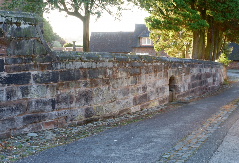
Wall, late medieval, C18 and mid C19, sandstone and brick. Probably late medieval of squared coursed rubble sandstone with steeply-weathered roll coping between lychgate (High Street) and Old School House (School Lane); C18 brickwork with plain stone coping dropping in quadrant steps east of Old School House; plain stone piers to secondary iron gates to School Lane; probably late medieval wall of coursed rubble sandstone to Southbank south of Lychgate with water-trough, formerly fed from churchyard, in arched recess; wall of 2 courses of large stone slabs, probably mid C19, to south side of churchyard along Southbank.
Listing NGR: SJ6650977498
External links are from the relevant listing authority and, where applicable, Wikidata. Wikidata IDs may be related buildings as well as this specific building. If you want to add or update a link, you will need to do so by editing the Wikidata entry.


Other nearby listed buildings