Latitude: 52.9172 / 52°55'2"N
Longitude: -1.2844 / 1°17'3"W
OS Eastings: 448212
OS Northings: 335773
OS Grid: SK482357
Mapcode National: GBR 7GN.03W
Mapcode Global: WHDGX.7XMZ
Plus Code: 9C4WWP88+V6
Entry Name: Sandiacre Lock
Listing Date: 2 May 1986
Grade: II
Source: Historic England
Source ID: 1087973
English Heritage Legacy ID: 82215
ID on this website: 101087973
Location: Sandiacre, Erewash, Derbyshire, NG10
County: Derbyshire
District: Erewash
Electoral Ward/Division: Derby Road East
Parish: Non Civil Parish
Built-Up Area: Sandiacre
Traditional County: Derbyshire
Lieutenancy Area (Ceremonial County): Derbyshire
Church of England Parish: Sandiacre St Giles
Church of England Diocese: Derby
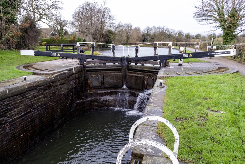
PARISH OF LONG EATON LOCK LANE SK 43 NE 2/30 (North Side) Sandiacre Lock GV II Lock chamber, gates and leat. 1779, by engineer John Varley, with subsequent repairs. Ashlar, partly rebuilt in engineering brick and concrete, with metal and wood gates. Lock chamber has original ashlar to west side but is mostly rebuilt in brick to east side. There are iron steps to either side and concrete copings to top. Wooden gates to either end have metal reinforced balance beams with metal handrails. Southern gates have barrel gearing for the paddles and northern gates have rack and pinion paddle mechanisms. To the side of each gate is a concrete semi-circle with stepping stones and to the sides of the chamber there are wooden and iron bollards. Leat, partly rebuilt in concrete, curves off to the west of the lock and returns to the canal below the canal bridge. Built as part of the Erewash Canal.
Listing NGR: SK4821235773
External links are from the relevant listing authority and, where applicable, Wikidata. Wikidata IDs may be related buildings as well as this specific building. If you want to add or update a link, you will need to do so by editing the Wikidata entry.


Other nearby listed buildings