Latitude: 52.9172 / 52°55'1"N
Longitude: -1.2845 / 1°17'4"W
OS Eastings: 448205
OS Northings: 335771
OS Grid: SK482357
Mapcode National: GBR 7GN.02S
Mapcode Global: WHDGX.7XKZ
Plus Code: 9C4WWP88+V5
Entry Name: Lock Keeper's Cottage and Attached Outbuilding at Sandiacre Lock
Listing Date: 2 May 1986
Grade: II
Source: Historic England
Source ID: 1204239
English Heritage Legacy ID: 82216
ID on this website: 101204239
Location: Sandiacre, Erewash, Derbyshire, NG10
County: Derbyshire
District: Erewash
Electoral Ward/Division: Derby Road East
Parish: Non Civil Parish
Built-Up Area: Sandiacre
Traditional County: Derbyshire
Lieutenancy Area (Ceremonial County): Derbyshire
Church of England Parish: Long Eaton St John
Church of England Diocese: Derby
Tagged with: Cottage
PARISH OF LONG EATON LOCK LANE SK 48NE 2/31 (North Side) Lock Keeper's Cottage and Attached out- building at Sandiacre Lock. GV II
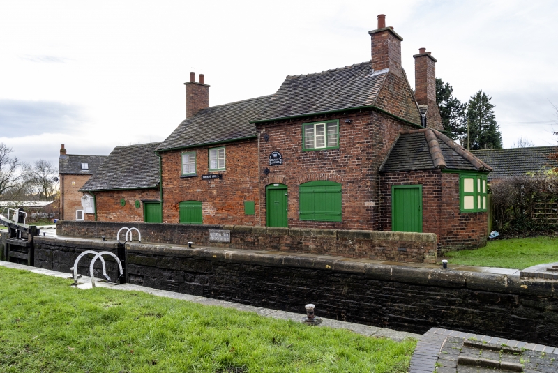
Lock keeper's cottage and attached outbuilding. Late C18 with later alterations. Red brick with plain tile roofs on three different levels plus brick gable stacks and plain eaves bands. Two storeys and three bays with northern bay taller than the other two, also with single storey outbuilding attached to south. Cottage has a segment headed doorcase with plank door to north and a segment headed 3-light window beyond. To south in the lower part is one small C20 window to north and double plank doors below segmental arch to south. Above, there are two 2-light C19 casements and a 3-light C19 casement to north. The north gable wall of the cottage, facing the junction of the River Erewash and the old Derby Canal, has a canted bay window with casements. Attached to the south of the cottage is an outbuilding with inserted double plank doors to north and a couple of large tie heads. The cottage was probably erected at the same time as the Derby Canal in 1795.
Listing NGR: SK4820535771
External links are from the relevant listing authority and, where applicable, Wikidata. Wikidata IDs may be related buildings as well as this specific building. If you want to add or update a link, you will need to do so by editing the Wikidata entry.


Other nearby listed buildings