Approximate Location Map
Large Map »
Latitude: 51.914 / 51°54'50"N
Longitude: -2.049 / 2°2'56"W
OS Eastings: 396723
OS Northings: 223942
OS Grid: SO967239
Mapcode National: GBR 2LZ.YKT
Mapcode Global: VHB1Q.F5M2
Plus Code: 9C3VWX72+J9
Entry Name: 9, the Burgage
Listing Date: 25 February 1987
Grade: II
Source: Historic England
Source ID: 1091934
English Heritage Legacy ID: 134453
ID on this website: 101091934
Location: Prestbury, Cheltenham, Gloucestershire, GL52
County: Gloucestershire
District: Cheltenham
Civil Parish: Prestbury
Built-Up Area: Cheltenham
Traditional County: Gloucestershire
Lieutenancy Area (Ceremonial County): Gloucestershire
Church of England Parish: Prestbury St Mary
Church of England Diocese: Gloucester
Tagged with: Building Thatched cottage
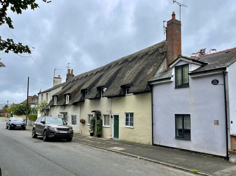
SO 9623 PRESTBURY THE BURGAGE
(west side)
19/49 No 9
GV II
Cottage in row. C17. Probably timber-framed now pebble-dashed.
Thatched roof with brick stack. Rectangular plan. 1½ storey, 2
bay facade. Single eyebrow dormer with C20 top opening casement to
first floor. Two-light casement with horizontal glazing bars to
ground floor to right of a C19 plank door with single-pane spy
light. Stack at right gable end. Interior not inspected.
Listing NGR: SO9672323942
External links are from the relevant listing authority and, where applicable, Wikidata. Wikidata IDs may be related buildings as well as this specific building. If you want to add or update a link, you will need to do so by editing the Wikidata entry.


Other nearby listed buildings
