Latitude: 51.0635 / 51°3'48"N
Longitude: -1.3192 / 1°19'9"W
OS Eastings: 447803
OS Northings: 129570
OS Grid: SU478295
Mapcode National: GBR 861.9UT
Mapcode Global: FRA 8639.RW4
Plus Code: 9C3W3M7J+98
Entry Name: 4, Castle Hill
Listing Date: 24 March 1950
Grade: II
Source: Historic England
Source ID: 1094714
English Heritage Legacy ID: 144465
ID on this website: 101094714
Location: The Close, Winchester, Hampshire, SO23
County: Hampshire
District: Winchester
Electoral Ward/Division: St Michael
Parish: Non Civil Parish
Built-Up Area: Winchester
Traditional County: Hampshire
Lieutenancy Area (Ceremonial County): Hampshire
Church of England Parish: Winchester St Lawrence with St Swithun-upon-Kingsgate
Church of England Diocese: Winchester
Tagged with: Building
1. 1833 CASTLE HILL No 4
SU 4729 NE 2/106 24.3.50.
II
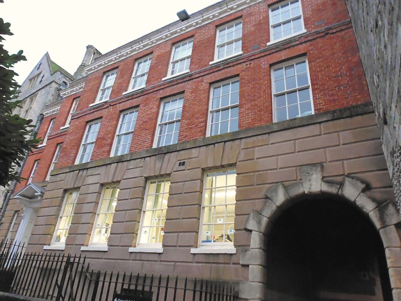
2. Mid C18. 3 storeys. Red brick with bands and rusticated stucco ground floor. Brick and stucco cornice with corbels in pairs. Brick parapet. Main front 5 windows sashes with glazing bars with two set backs at South end each with 1 window. Good panelled door in first set back at South end with fluted frieze and open pedimented hood on carved brackets. Panelled reveals to opening. North end includes rusticated arched passage (footvay to West Gate). Roof not visible.
Listing NGR: SU4751629417
External links are from the relevant listing authority and, where applicable, Wikidata. Wikidata IDs may be related buildings as well as this specific building. If you want to add or update a link, you will need to do so by editing the Wikidata entry.


Other nearby listed buildings