Latitude: 51.0637 / 51°3'49"N
Longitude: -1.3198 / 1°19'11"W
OS Eastings: 447760
OS Northings: 129596
OS Grid: SU477295
Mapcode National: GBR 861.94M
Mapcode Global: FRA 8639.RNF
Plus Code: 9C3W3M7J+F3
Entry Name: Westgate Hotel
Listing Date: 14 January 1974
Grade: II
Source: Historic England
Source ID: 1095407
English Heritage Legacy ID: 144735
ID on this website: 101095407
Location: Hyde, Winchester, Hampshire, SO23
County: Hampshire
District: Winchester
Electoral Ward/Division: St Paul
Parish: Non Civil Parish
Built-Up Area: Winchester
Traditional County: Hampshire
Lieutenancy Area (Ceremonial County): Hampshire
Church of England Parish: Winchester St Lawrence with St Swithun-upon-Kingsgate
Church of England Diocese: Winchester
Tagged with: Hotel
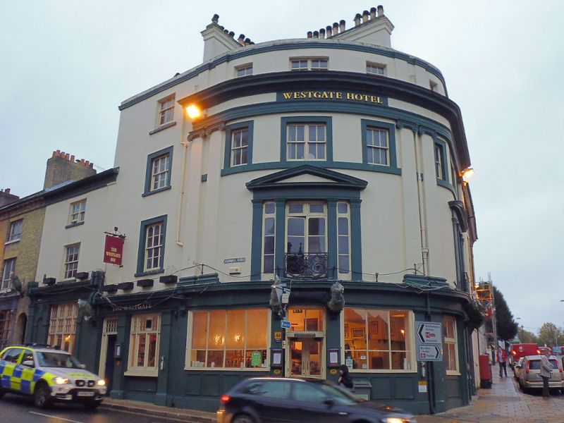
ROMSEY ROAD 1. 1833 (North Side) ------------ Westgate Hotel with Nos 2 to 10 (even) SU 4729 NE 2/402 II 2. (With Nos 3 and 4 Upper High Street). The block is of the same build but the Westgate Hotel forms the grander centrepiece. Mid C19. Westgate Hotel. Rendered. Curved frontage. Three storeys and attic, two windows on first floor, six on second floor. Three pairs of giant Ionic pilasters. The first floor sashes have paired pilaster surrounds and pedimented heads. Dentil frieze with attic storey above. Simple classical public house frontage on ground. Parapet, roof not visible. Nos 2 to 10 (even) Romsey Road and Nos 3 and 4 Upper High Street. Yellow brick. Three storeys, one window, mostly sashes with glazing bars. Some modern shopfronts. Arched doorways. Modillion cornice, slate roof. Important position.
Listing NGR: SU4775829603
External links are from the relevant listing authority and, where applicable, Wikidata. Wikidata IDs may be related buildings as well as this specific building. If you want to add or update a link, you will need to do so by editing the Wikidata entry.


Other nearby listed buildings