Latitude: 51.0641 / 51°3'50"N
Longitude: -1.3198 / 1°19'11"W
OS Eastings: 447762
OS Northings: 129633
OS Grid: SU477296
Mapcode National: GBR 861.94J
Mapcode Global: FRA 8639.RN9
Plus Code: 9C3W3M7J+J3
Entry Name: Memorial of the Plague
Listing Date: 24 March 1950
Grade: II*
Source: Historic England
Source ID: 1095345
English Heritage Legacy ID: 144878
ID on this website: 101095345
Location: Hyde, Winchester, Hampshire, SO23
County: Hampshire
District: Winchester
Electoral Ward/Division: St Paul
Parish: Non Civil Parish
Built-Up Area: Winchester
Traditional County: Hampshire
Lieutenancy Area (Ceremonial County): Hampshire
Church of England Parish: Winchester Holy Trinity
Church of England Diocese: Winchester
UPPER HIGH STREET
1.
1833
(East Side)
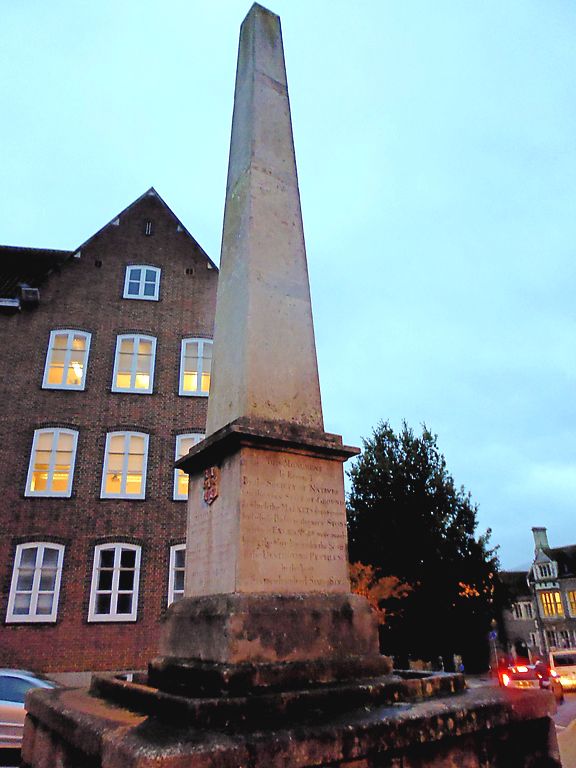
Memorial of The Plague
SU 4729 NE 2/276 24.3.50.
II*
2.
1759, rebuilt 1821 on site of earlier memorial of plague 1666. Portland
stone obelisk with inscription on square rusticated base. The memorial
was erected by the Charitable Society of Natives - a society founded to
help the survivors of the Great Plague of 1666. Very good inscription.
Listing NGR: SU4773829627
External links are from the relevant listing authority and, where applicable, Wikidata. Wikidata IDs may be related buildings as well as this specific building. If you want to add or update a link, you will need to do so by editing the Wikidata entry.


Other nearby listed buildings