Latitude: 51.0635 / 51°3'48"N
Longitude: -1.3191 / 1°19'8"W
OS Eastings: 447812
OS Northings: 129576
OS Grid: SU478295
Mapcode National: GBR 861.9B5
Mapcode Global: FRA 8639.RY9
Plus Code: 9C3W3M7J+C9
Entry Name: The Westgate
Listing Date: 24 March 1950
Grade: I
Source: Historic England
Source ID: 1350695
English Heritage Legacy ID: 144612
Also known as: Westgate, Winchester
The West Gate
ID on this website: 101350695
Location: The Close, Winchester, Hampshire, SO23
County: Hampshire
District: Winchester
Electoral Ward/Division: St Michael
Parish: Non Civil Parish
Built-Up Area: Winchester
Traditional County: Hampshire
Lieutenancy Area (Ceremonial County): Hampshire
Church of England Parish: Winchester Holy Trinity
Church of England Diocese: Winchester
Tagged with: Fortified gateway
1.
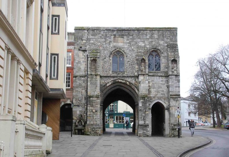
1833 HIGH STREET
(South Side)
The Westgate
SU 4729 NE 2/107 24.3.50.
I
2.
Mainly C13 and C14. Flint and Stone. Central arch and smaller flanking
arch. Large buttresses to East Front. One of the two remaining City
Gates. AM.
Listing NGR: SU4848629368
External links are from the relevant listing authority and, where applicable, Wikidata. Wikidata IDs may be related buildings as well as this specific building. If you want to add or update a link, you will need to do so by editing the Wikidata entry.


Other nearby listed buildings