Latitude: 50.5231 / 50°31'23"N
Longitude: -3.5296 / 3°31'46"W
OS Eastings: 291668
OS Northings: 70376
OS Grid: SX916703
Mapcode National: GBR P1.Q68T
Mapcode Global: FRA 37HP.2RR
Plus Code: 9C2RGFFC+65
Entry Name: Higher Farm Including Cider Cellar to the South and Walls to the North and West
Listing Date: 2 December 1988
Grade: II
Source: Historic England
Source ID: 1097609
English Heritage Legacy ID: 86055
ID on this website: 101097609
Location: Stokeinteignhead, Teignbridge, Devon, TQ12
County: Devon
District: Teignbridge
Civil Parish: Stokeinteignhead
Built-Up Area: Stokeinteignhead
Traditional County: Devon
Lieutenancy Area (Ceremonial County): Devon
Church of England Parish: Stokeinteignhead St Andrew
Church of England Diocese: Exeter
Tagged with: Building
STOKEINTEIGNHEAD STOKE ROAD (east side), SX 9070-9170 Stokeinteignhead Higher Farm including cider cellar 17/413 to the south and walls to the north - and west
GV II
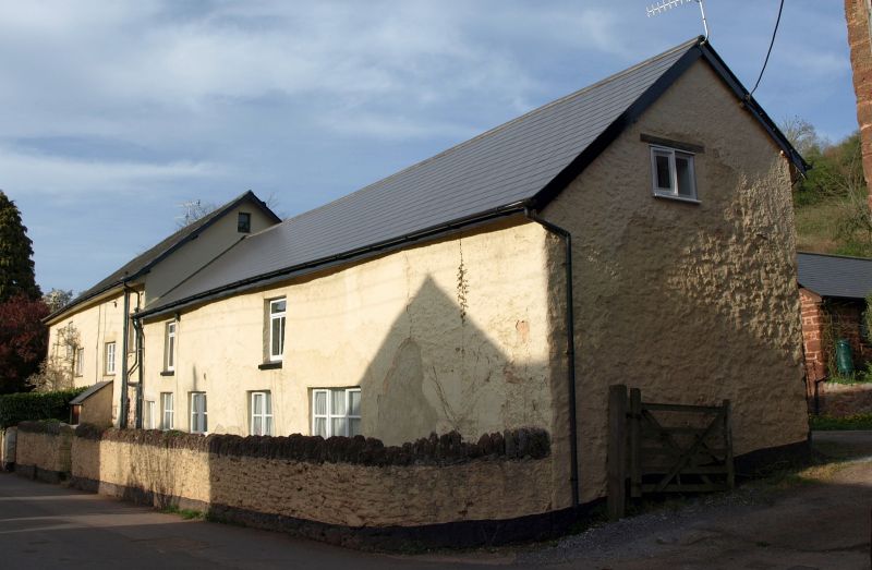
Farmhouse including adjoining cider cellar and walls to garden to the north and west and walls to narrow yard in front of the cider cellar. House probably a mid C19 extension and remodelling of an earlier house, cider cellar probably mid C19. Colourwashed rendered cob and stone rubble: slate roof (2 different heights) hipped at right end of north block. Axial stack to north block, projecting rear lateral stack to service wing. Plan: Overall L plan. The 2 principal rooms of the house face north, a rear right service wing, parallel to the road and at right angles to the north-facing block contains the kitchen, service rooms and the cider cellar. The kitchen, heated by a lateral stack, and the service rooms are probably part of a C17 or earlier single depth house, possibly truncated in the mid C19 when the new principal rooms were added, and reduced to a service wing at this date. 2 entrances on the west side; one into a passage which runs between the service wing and principal rooms, another between the cider cellar and the kitchen. Exterior: 2 storeys. Deep eaves. Asymmetrical 5:2 window west elevation, parallel with Stoke Road (the 2 windows to the cider cellar, which has a lower roofline). Front door with a C19 overlight to left of centre into the passage between the main (north) block and the wing, recessed C19 panelled door to the extreme right of the service wing. Scattered fenestration of probably C19 timber casement windows with small panes, blind recess to first floor left. Handsome cider cellar to the right with 2 first floor casements, a recessed door in a doorway with a timber lintel to the left, and 2 unglazed ground floor windows. The north elevation, facing the garden, has regular fenestration of 2 first floor and 2 ground floor C19 3-light timber casements with glazing bars. The building is slightly set back from the road behind rendered and stone rubble walls. The walls to the garden north and west are tall, and capped with tiles. A lower stone rubble wall west of the west elevation has irregular stone capping in front of the cider cellar. Interior: Well-preserved. The open kitchen fireplace has a brick lintel: no exposed carpentry to kitchen. C19 features survive in the principal rooms including joinery and a chimney-piece. The cider cellar, still in use, has a pitched stone floor. An attractive irregular range, group value with the cottages opposite and a fine farmbuilding to the south, making an important contribution to the village streetscape: the only working farm left in the village.
Listing NGR: SX9166870376
External links are from the relevant listing authority and, where applicable, Wikidata. Wikidata IDs may be related buildings as well as this specific building. If you want to add or update a link, you will need to do so by editing the Wikidata entry.


Other nearby listed buildings