Latitude: 50.6793 / 50°40'45"N
Longitude: -3.2398 / 3°14'23"W
OS Eastings: 312503
OS Northings: 87365
OS Grid: SY125873
Mapcode National: GBR P8.XSV8
Mapcode Global: FRA 4738.TXW
Plus Code: 9C2RMQH6+P3
Entry Name: Hope Cottage
Listing Date: 12 November 1973
Grade: II
Source: Historic England
Source ID: 1097954
English Heritage Legacy ID: 87276
ID on this website: 101097954
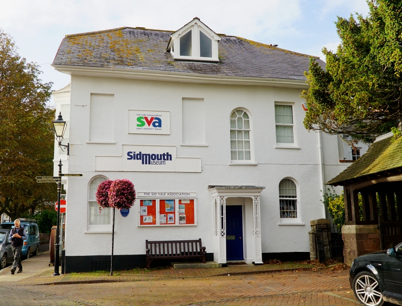
COBURG ROAD 1. 1633 (North East Side) Hope Cottage SY 1287 1/41 II GV 2. Corner site in Coburg Road. 2 storey L plan stucco faced house circa 1830. Hipped and gable end slate roofs with projecting eaves. The corner block with Church Street has a steeper pitch to the roof with attic, hipped gable end to west. The elevation facing down Church Street is asymmetrical: 4 windows on 1st floor, 2 blind the others sashes, that above porch with radial glazing bars to rounded head. The ground floor has 2 round headed sash windows and trellis porch with flat roof and cornice. The west front to Coburg Road has 5 windows on 1st floor, 4 on ground floor with central doorway. The 2 first floor windows below hipped gable are later canted bays with tent roofs and rendered aprons. Other windows 2 and 3-light casements with Venetian shutters. The centred door is of 2 flush and 4 fielded panels. Above is a projecting cornice hood on small shaped brackets. The house has an important position in relation to the Parish Church; also Amyatt's Terrace Coburg Road and the open grouping of Regency buildings in this part of the town.
Hope Cottage forms a group with the War Memorial Service Men's Club and Harston in Church Street.
Listing NGR: SY1250387365
External links are from the relevant listing authority and, where applicable, Wikidata. Wikidata IDs may be related buildings as well as this specific building. If you want to add or update a link, you will need to do so by editing the Wikidata entry.


Other nearby listed buildings