Latitude: 51.8945 / 51°53'40"N
Longitude: -2.0722 / 2°4'19"W
OS Eastings: 395126
OS Northings: 221774
OS Grid: SO951217
Mapcode National: GBR 2MB.4XG
Mapcode Global: VHB1Q.1NC1
Plus Code: 9C3VVWVH+Q4
Entry Name: Vanstone
Listing Date: 5 May 1972
Grade: II
Source: Historic England
Source ID: 1104258
English Heritage Legacy ID: 474573
ID on this website: 101104258
Location: Coltham Fields, Cheltenham, Gloucestershire, GL53
County: Gloucestershire
District: Cheltenham
Electoral Ward/Division: College
Parish: Non Civil Parish
Built-Up Area: Cheltenham
Traditional County: Gloucestershire
Lieutenancy Area (Ceremonial County): Gloucestershire
Church of England Parish: Cheltenham St Luke and St John
Church of England Diocese: Gloucester
Tagged with: Building
CHELTENHAM
SO9521NW COLLEGE ROAD 630-1/19/293 (East side) 05/05/72 No.38 Vanstone
GV II
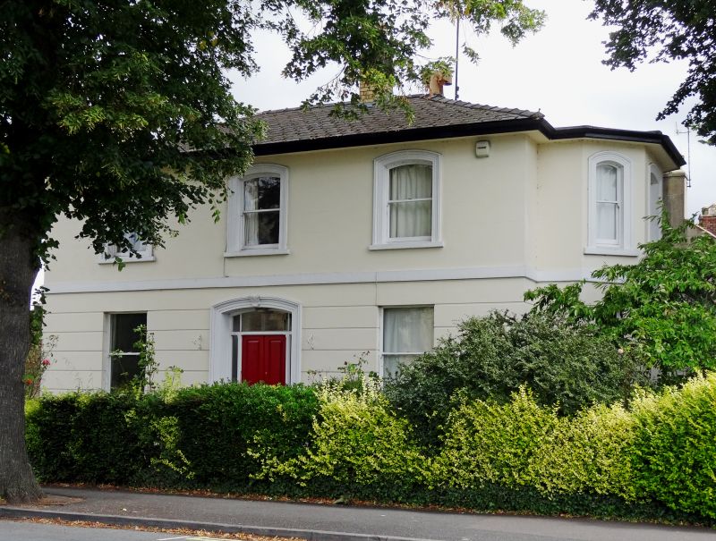
Also known as: St Luke's Vicarage COLLEGE ROAD. Marked on OS as No.38, Vicarage. Villa, now St Luke's vicarage. c1840-60. Stucco over brick with hipped slate roof, 2 left end gault brick stacks with cornices, with wrought-iron balcony. Double depth plan with central hallway. EXTERIOR: 2 storeys, 3 first-floor windows. Stucco detailing includes horizontal rustication to ground floor; first-floor band; tooled architraves to first-floor windows; sills. 1/1 sashes throughout, those to first floor with cambered heads. Central entrance: 4-fielded-panel double doors with side-lights under cambered overlight in tooled surround with acanthus keystone. Wide eaves. Right return has full-height and ground-floor canted bays with similar fenestration and cornice to ground-floor bay. INTERIOR: reputed to retain original plasterwork, otherwise not inspected. SUBSIDIARY FEATURES: balcony over bay window to right return has open-scroll motif. Forms a group with Church of St Luke, St Luke's Road (qv) for which it has been the vicarage since c1970.
Listing NGR: SO9512621769
External links are from the relevant listing authority and, where applicable, Wikidata. Wikidata IDs may be related buildings as well as this specific building. If you want to add or update a link, you will need to do so by editing the Wikidata entry.


Other nearby listed buildings