Approximate Location Map
Large Map »
Latitude: 53.0483 / 53°2'54"N
Longitude: -1.7684 / 1°46'6"W
OS Eastings: 415620
OS Northings: 350144
OS Grid: SK156501
Mapcode National: GBR 488.XBZ
Mapcode Global: WHCDY.TM2Y
Plus Code: 9C5W26XJ+8J
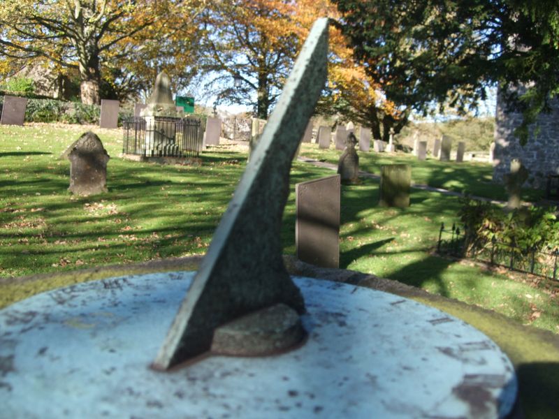
Entry Name: Sundial in Churchyard, 10 Yards South of South Porch
Listing Date: 14 June 1984
Grade: II
Source: Historic England
Source ID: 1109303
English Heritage Legacy ID: 80378
ID on this website: 101109303
Location: St Leonard's Church, Thorpe, Derbyshire Dales, Derbyshire, DE6
County: Derbyshire
District: Derbyshire Dales
Civil Parish: Thorpe
Traditional County: Derbyshire
Lieutenancy Area (Ceremonial County): Derbyshire
Church of England Parish: Thorpe St Leonard
Church of England Diocese: Derby
Tagged with: Sundial
SK 15 SE PARISH OF THORPE DIGMIRE LANE
5/108 (East Side)
Sundial in churchyard, 10
yards south of south porch
GV II
Sundial. 1767 by Whitehurst of Derby. Gritstone pillar, square in plan, with
tapering sides, c5 feet tall. Moulded base and cap and broad flat plinth. The
sundial is still in position on top.
Listing NGR: SK1562050144
External links are from the relevant listing authority and, where applicable, Wikidata. Wikidata IDs may be related buildings as well as this specific building. If you want to add or update a link, you will need to do so by editing the Wikidata entry.


Other nearby listed buildings
