Approximate Location Map
Large Map »
Latitude: 53.0514 / 53°3'4"N
Longitude: -1.7831 / 1°46'59"W
OS Eastings: 414634
OS Northings: 350477
OS Grid: SK146504
Mapcode National: GBR 488.L0N
Mapcode Global: WHCDY.LK3M
Plus Code: 9C5W3628+GP
Entry Name: St Marys Bridge (East)
Listing Date: 14 June 1984
Grade: II
Source: Historic England
Source ID: 1109304
English Heritage Legacy ID: 80380
ID on this website: 101109304
Location: Thorpe, Derbyshire Dales, Derbyshire, DE6
County: Derbyshire
District: Derbyshire Dales
Civil Parish: Thorpe
Traditional County: Derbyshire
Lieutenancy Area (Ceremonial County): Derbyshire
Church of England Parish: Thorpe St Leonard
Church of England Diocese: Derby
Tagged with: Building Road bridge
SK 15 SW PARISH OF THORPE ILAM ROAD
4/110
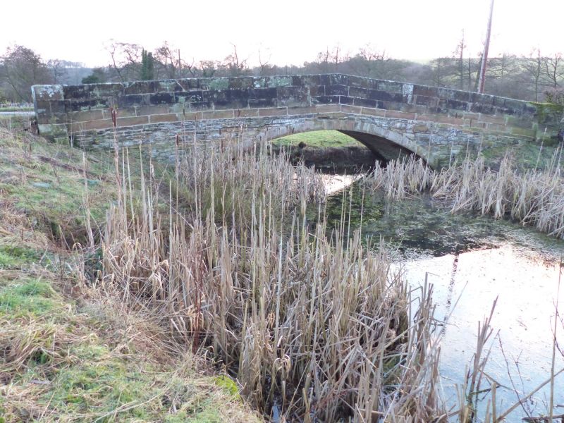
St Marys Bridge (East)
GV II
Bridge, 1790. Coursed squared gritstone. Single segmental arch and canted
parapet walls with chamfered copings. Foundation stone on the north wall
inscribed: St Marys Bridge/Built Anno 1790/This Stone Laid 15 March/And/
Finished 15 April
Listing NGR: SK1463450477
External links are from the relevant listing authority and, where applicable, Wikidata. Wikidata IDs may be related buildings as well as this specific building. If you want to add or update a link, you will need to do so by editing the Wikidata entry.


Other nearby listed buildings
