Latitude: 53.1996 / 53°11'58"N
Longitude: -1.4484 / 1°26'54"W
OS Eastings: 436944
OS Northings: 367091
OS Grid: SK369670
Mapcode National: GBR 69M.DMW
Mapcode Global: WHDFG.QTGZ
Plus Code: 9C5W5HX2+RJ
Entry Name: Roadbridge and Associated Enclosure Walls Comprising the Sheepwash at SK369671
Listing Date: 30 August 1995
Grade: II
Source: Historic England
Source ID: 1116722
English Heritage Legacy ID: 393545
ID on this website: 101116722
Location: Hardwick Wood, North East Derbyshire, S42
County: Derbyshire
District: North East Derbyshire
Civil Parish: Wingerworth
Traditional County: Derbyshire
Lieutenancy Area (Ceremonial County): Derbyshire
Church of England Parish: Wingerworth All Saints
Church of England Diocese: Derby
Tagged with: Building
WINGERWORTH SK36NE HILLHOUSES LANE 1264-0/6/144 (North side) Road Bridge and associated enclosure walls comprising the sheepwash at SK369671
II
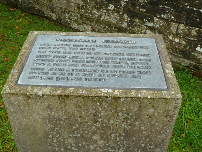
Road bridge and associated sheepwash. Early C19. Ashlar and coursed rubble Coal Measures Sandstone. Flat road bridge with massive flagged base, supported on substantial central masonry pier, pointed at ends to form cutwaters. The north-western end of this pier, and the lining walls to the stream channel, are grooved to accept stop planks, to create the pond for the sheepwash. The north-west parapet of the bridge is linked with the twin curved walls which extend from either end of the bridge on its north-western side, and which form small walled enclosures, with half-round copings, on each side of Tricket Brook. At the north-eastern end of the bridge, a stone setted way leads from the lane, onto a setted ramp leading out of the sheepwash. Each enclosure wall has a narrow gateway onto the lane.
Listing NGR: SK3694467091
External links are from the relevant listing authority and, where applicable, Wikidata. Wikidata IDs may be related buildings as well as this specific building. If you want to add or update a link, you will need to do so by editing the Wikidata entry.


Other nearby listed buildings