Latitude: 52.187 / 52°11'13"N
Longitude: -2.1256 / 2°7'32"W
OS Eastings: 391507
OS Northings: 254314
OS Grid: SO915543
Mapcode National: GBR 1G8.WZ4
Mapcode Global: VH92W.39M8
Plus Code: 9C4V5VPF+RP
Entry Name: Churchill Wood Farmhouse
Listing Date: 11 February 1965
Grade: II
Source: Historic England
Source ID: 1116922
English Heritage Legacy ID: 442620
ID on this website: 101116922
Location: Broughton Hackett, Wychavon, Worcestershire, WR7
County: Worcestershire
District: Wychavon
Civil Parish: Churchill
Traditional County: Worcestershire
Lieutenancy Area (Ceremonial County): Worcestershire
Church of England Parish: White Ladies Aston with Churchill and Spetchley
Church of England Diocese: Worcester
Tagged with: Farmhouse
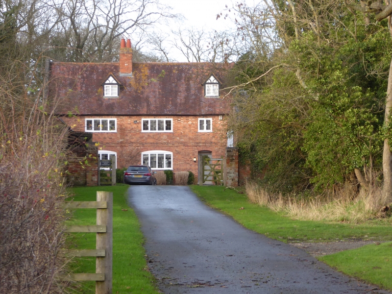
CHURCHILL CHURCHILL
1.
2301
Churchill Wood Farmhouse
SO 95 SW 5/210 11.2.65.
II
2.
Late C17. Long brick house With 2 original timber framed dormers. Casement
windows with leaded lights. Tile roof with coped gable ends.
Listing NGR: SO9150754314
External links are from the relevant listing authority and, where applicable, Wikidata. Wikidata IDs may be related buildings as well as this specific building. If you want to add or update a link, you will need to do so by editing the Wikidata entry.


Other nearby listed buildings