Approximate Location Map
Large Map »
Latitude: 52.1888 / 52°11'19"N
Longitude: -2.1113 / 2°6'40"W
OS Eastings: 392486
OS Northings: 254514
OS Grid: SO924545
Mapcode National: GBR 2HM.M20
Mapcode Global: VH92W.C75W
Plus Code: 9C4V5VQQ+GF
Entry Name: Tudor House
Listing Date: 3 August 1972
Grade: II
Source: Historic England
Source ID: 1116973
English Heritage Legacy ID: 442518
ID on this website: 101116973
Location: Broughton Hackett, Wychavon, Worcestershire, WR7
County: Worcestershire
District: Wychavon
Civil Parish: Broughton Hackett
Traditional County: Worcestershire
Lieutenancy Area (Ceremonial County): Worcestershire
Church of England Parish: Broughton Hackett
Church of England Diocese: Worcester
Tagged with: House
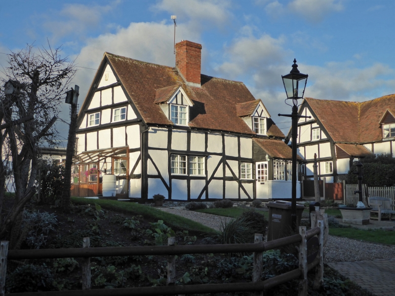
BROUGHTON HACKETT BROUGHTON HACKETT
1.
2301
Tudor House
SO 95 SW 5/188
II
2.
C17, timber framed cottage with plaster faced infilling and tile roof.
Small rectangular plan. 2 modern gabled dormers. Centre chimney. Gable
ends.
Listing NGR: SO9248654514
External links are from the relevant listing authority and, where applicable, Wikidata. Wikidata IDs may be related buildings as well as this specific building. If you want to add or update a link, you will need to do so by editing the Wikidata entry.


Other nearby listed buildings
