Latitude: 52.3958 / 52°23'44"N
Longitude: 0.2698 / 0°16'11"E
OS Eastings: 554532
OS Northings: 279954
OS Grid: TL545799
Mapcode National: GBR M6H.WHH
Mapcode Global: VHHJD.M1GQ
Plus Code: 9F4297W9+8W
Entry Name: 54, Quayside
Listing Date: 19 June 1972
Grade: II
Source: Historic England
Source ID: 1126496
English Heritage Legacy ID: 48771
ID on this website: 101126496
Location: Ely, East Cambridgeshire, CB7
County: Cambridgeshire
District: East Cambridgeshire
Civil Parish: Ely
Built-Up Area: Ely
Traditional County: Cambridgeshire
Lieutenancy Area (Ceremonial County): Cambridgeshire
Church of England Parish: Ely
Church of England Diocese: Ely
Tagged with: Building
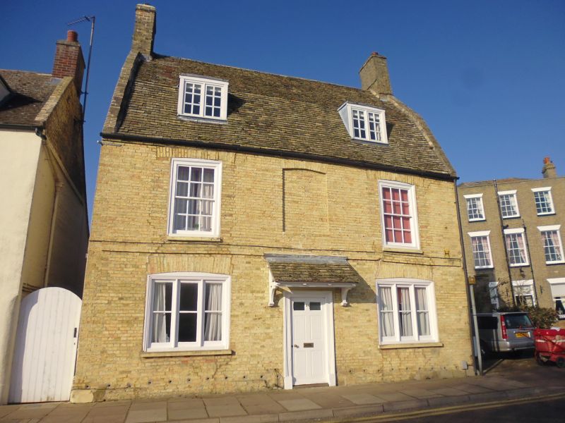
QUAYSIDE
1.
1082 No 54
TL 5479 2/28
II GV
2.
A C18 brick house, now painted. 2 storeys and attics. 3 window range,
double-hung sashes with glazing bars, in flush cased frames on the 1st
storey (the centre window is blocked). The ground storey windows are
3-light casements. A raised brick band runs between the storeys. Roof
tiled (Old Cambridgeshire tiles), with stopped gables and 2 flat headed
dormers.
Nos 54 to 64 (even), Ely Maltings, & No 68 (Malting Cottage) form a group with
Nos 51 to 53 (consec), Malthouse adjoining No 53, Quay House, & No 55 and the
House adjoining No 55 Waterside.
Listing NGR: TL5453279954
External links are from the relevant listing authority and, where applicable, Wikidata. Wikidata IDs may be related buildings as well as this specific building. If you want to add or update a link, you will need to do so by editing the Wikidata entry.


Other nearby listed buildings