Latitude: 52.2207 / 52°13'14"N
Longitude: 0.1712 / 0°10'16"E
OS Eastings: 548413
OS Northings: 260276
OS Grid: TL484602
Mapcode National: GBR M8H.N46
Mapcode Global: VHHK3.XFCY
Plus Code: 9F4265CC+7F
Entry Name: 19 and 21, High Street
Listing Date: 22 August 1984
Grade: II
Source: Historic England
Source ID: 1127397
English Heritage Legacy ID: 50569
ID on this website: 101127397
Location: Fen Ditton, South Cambridgeshire, CB5
County: Cambridgeshire
District: South Cambridgeshire
Civil Parish: Fen Ditton
Built-Up Area: Fen Ditton
Traditional County: Cambridgeshire
Lieutenancy Area (Ceremonial County): Cambridgeshire
Church of England Parish: Fen Ditton St Mary the Virgin
Church of England Diocese: Ely
Tagged with: Building Thatched cottage
TL 4860-4960 FEN DITTON HIGH STREET
(South Side)
18/18 Nos. 19 & 21
GV II
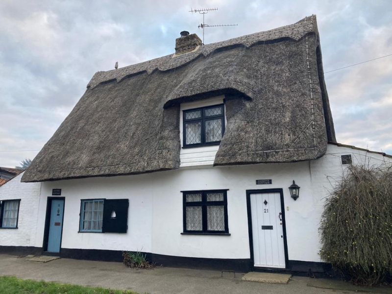
Pair of cottages. Early C19. Timber-framed and plastered.
Long straw thatched roof. Tall local brick ridge stack. Red
pantiled and painted brick gable lean tos to east and west. One
storey and attic. One modern casement dormer window, and
similar replacement casement window to left hand of main
entrance to No. 21. Horizontal sliding sash window with glazing
bars and shutters to No. 19 with boarded door.
R.C.H.M.: East Cambs p. 62, mon. 31.
Listing NGR: TL4841360276
External links are from the relevant listing authority and, where applicable, Wikidata. Wikidata IDs may be related buildings as well as this specific building. If you want to add or update a link, you will need to do so by editing the Wikidata entry.


Other nearby listed buildings