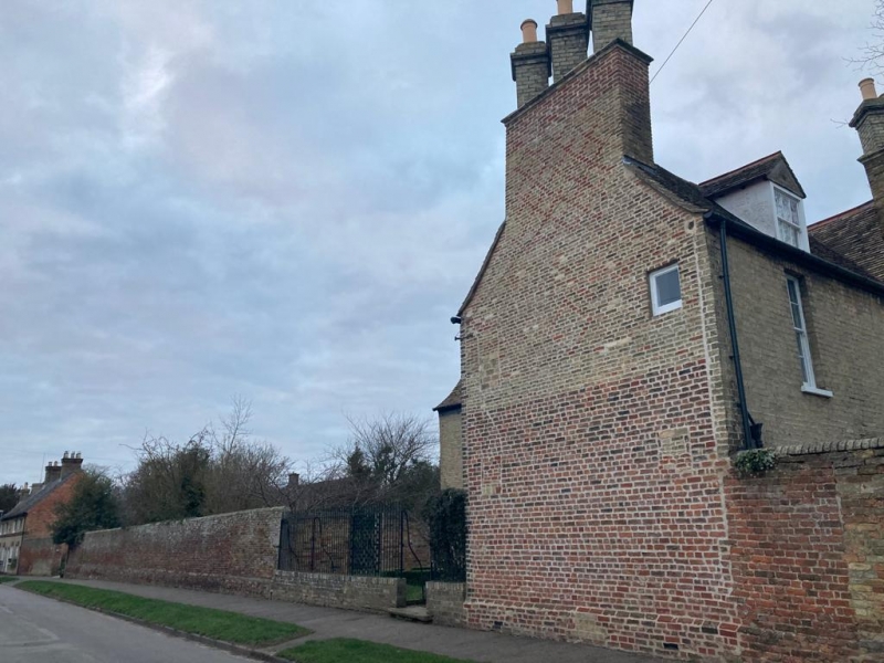
Latitude: 52.2208 / 52°13'14"N
Longitude: 0.1717 / 0°10'17"E
OS Eastings: 548442
OS Northings: 260282
OS Grid: TL484602
Mapcode National: GBR M8H.N7H
Mapcode Global: VHHK3.XFLX
Plus Code: 9F4265CC+8M
Entry Name: Wall to West of Numbers 16, 20 and 22
Listing Date: 22 August 1984
Grade: II
Source: Historic England
Source ID: 1157174
English Heritage Legacy ID: 50571
ID on this website: 101157174
Location: Fen Ditton, South Cambridgeshire, CB5
County: Cambridgeshire
District: South Cambridgeshire
Town: South Cambridgeshire
Civil Parish: Fen Ditton
Built-Up Area: Fen Ditton
Traditional County: Cambridgeshire
Lieutenancy Area (Ceremonial County): Cambridgeshire
Church of England Parish: Fen Ditton St Mary the Virgin
Church of England Diocese: Ely
Tagged with: Wall
The following item: FEN DITTON High Street (North Side) 18/20 Wall to east of No 16 (The Rectory)
shall be amended to read FEN DITTON High Street (North Side) Wall to west of Nos 16, 20 and 22
------------------------------------
TL 4860-4960 FEN DITTON HIGH STREET (North Side)
18/20 Wall to east of No. 16 (The Rectory)
GV II
Boundary wall to street. Late C17. Local red and yellow brick with plinth and brick copings of half round gault brick. Bricks originally coursed in chequer pattern, upper courses relaid. Included for group value with The Rectory.
Listing NGR: TL4844260282
External links are from the relevant listing authority and, where applicable, Wikidata. Wikidata IDs may be related buildings as well as this specific building. If you want to add or update a link, you will need to do so by editing the Wikidata entry.


Other nearby listed buildings