Approximate Location Map
Large Map »
Latitude: 51.3789 / 51°22'44"N
Longitude: -2.7643 / 2°45'51"W
OS Eastings: 346902
OS Northings: 164706
OS Grid: ST469647
Mapcode National: GBR JH.S9CZ
Mapcode Global: VH88Y.1LHS
Plus Code: 9C3V96HP+H7
Entry Name: Parish Boundary Stone
Listing Date: 19 January 1987
Grade: II
Source: Historic England
Source ID: 1129205
English Heritage Legacy ID: 33970
ID on this website: 101129205
Location: North Somerset, BS40
County: North Somerset
Civil Parish: Congresbury
Traditional County: Somerset
Lieutenancy Area (Ceremonial County): Somerset
Tagged with: Boundary marker
ST 46 SE
5/103
CONGRESBURY CP
CLEEVE HILL ROAD (west side)
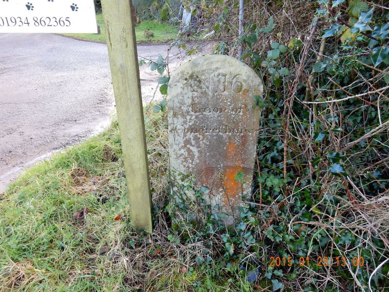
Parish Boundary Stone
II
Parish Boundary Marker. Late C18. Limestone. 0.5 metres high with segmental
top and incised lettering: 'N16/Manor of Congresbury'.
Listing NGR: ST4690264706
External links are from the relevant listing authority and, where applicable, Wikidata. Wikidata IDs may be related buildings as well as this specific building. If you want to add or update a link, you will need to do so by editing the Wikidata entry.


Other nearby listed buildings
