Latitude: 53.6567 / 53°39'24"N
Longitude: -1.7365 / 1°44'11"W
OS Eastings: 417508
OS Northings: 417832
OS Grid: SE175178
Mapcode National: GBR JV94.VX
Mapcode Global: WHCB2.9CB1
Plus Code: 9C5WM747+M9
Entry Name: Barn at Jagger Hill
Listing Date: 29 September 1978
Grade: II
Source: Historic England
Source ID: 1134164
English Heritage Legacy ID: 340007
ID on this website: 101134164
Location: Dalton, Kirklees, West Yorkshire, HD5
County: Kirklees
Electoral Ward/Division: Dalton
Parish: Non Civil Parish
Traditional County: Yorkshire
Lieutenancy Area (Ceremonial County): West Yorkshire
Church of England Parish: Kirkheaton St John the Baptist
Church of England Diocese: Leeds
Tagged with: Barn
JAGGER LANE
1.
5113
(West Side)
Kirkheaton
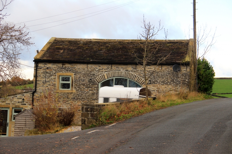
Barn at Jagger Hill
SE 1717 29/684
II GV
2.
Probably C19. Hammer dressed stone. Pitched stone slate roof. Segmentally-shaped
voussoirs to former arch. Included for group value.
Listing NGR: SE1750817832
External links are from the relevant listing authority and, where applicable, Wikidata. Wikidata IDs may be related buildings as well as this specific building. If you want to add or update a link, you will need to do so by editing the Wikidata entry.


Other nearby listed buildings