Approximate Location Map
Large Map »
Latitude: 53.6565 / 53°39'23"N
Longitude: -1.7366 / 1°44'11"W
OS Eastings: 417507
OS Northings: 417807
OS Grid: SE175178
Mapcode National: GBR JV94.VZ
Mapcode Global: WHCB2.9C97
Plus Code: 9C5WM747+H9
Entry Name: Jagger Hill
Listing Date: 29 September 1978
Grade: II
Source: Historic England
Source ID: 1213544
English Heritage Legacy ID: 340006
ID on this website: 101213544
Location: Dalton, Kirklees, West Yorkshire, HD5
County: Kirklees
Electoral Ward/Division: Dalton
Parish: Non Civil Parish
Traditional County: Yorkshire
Lieutenancy Area (Ceremonial County): West Yorkshire
Church of England Parish: Kirkheaton St John the Baptist
Church of England Diocese: Leeds
Tagged with: Building Architectural structure
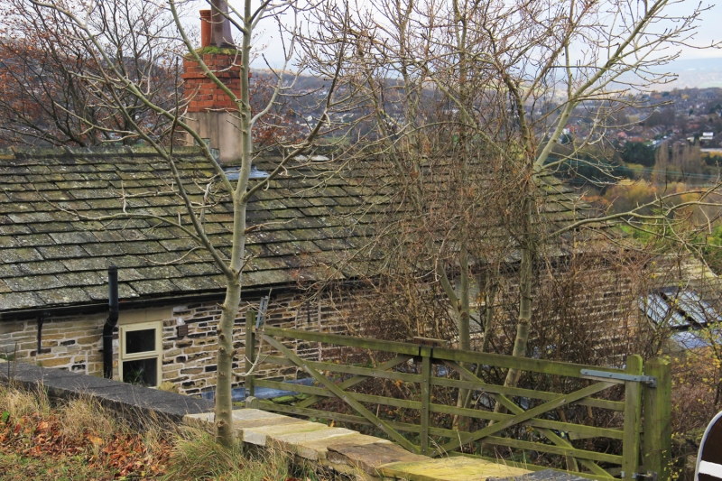
JAGGER LANE
1.
5113
(West Side)
Kirkheaton
Nos 24 and 26
(Jagger Hill)
SE 1717 29/683
II GV
2.
Probably C19. Hammer dressed stone. Pitched stone slate roof. 2 storeys.
2 ranges of 3-light stone mullioned windows. Lean-to outshut to rear.
Listing NGR: SE1750717807
External links are from the relevant listing authority and, where applicable, Wikidata. Wikidata IDs may be related buildings as well as this specific building. If you want to add or update a link, you will need to do so by editing the Wikidata entry.


Other nearby listed buildings
