Approximate Location Map
Large Map »
Latitude: 53.655 / 53°39'17"N
Longitude: -1.7382 / 1°44'17"W
OS Eastings: 417397
OS Northings: 417640
OS Grid: SE173176
Mapcode National: GBR JV95.GJ
Mapcode Global: WHCB2.8DJC
Plus Code: 9C5WM736+XP
Entry Name: Bankside
Listing Date: 29 September 1978
Grade: II
Source: Historic England
Source ID: 1290432
English Heritage Legacy ID: 339711
ID on this website: 101290432
Location: Dalton, Kirklees, West Yorkshire, HD5
County: Kirklees
Electoral Ward/Division: Dalton
Parish: Non Civil Parish
Built-Up Area: Huddersfield
Traditional County: Yorkshire
Lieutenancy Area (Ceremonial County): West Yorkshire
Church of England Parish: Kirkheaton St John the Baptist
Church of England Diocese: Leeds
Tagged with: Building
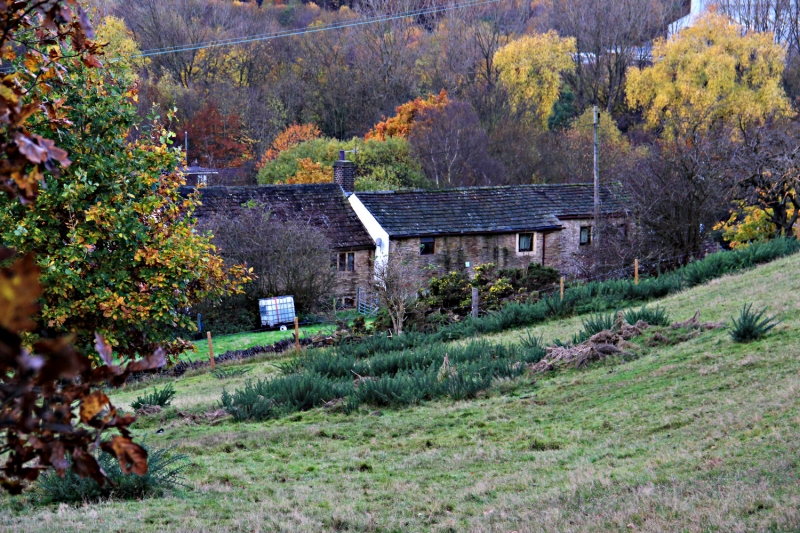
COLD ROYD LANE
1.
5113 (North Side)
Bankside
SE 1717 29/380
II
2.
Group of C17 cottages. Hammer-dressed stone. Pitched stone slate roof. 2
storeys. Irregular plan. Various 4, 2 and 3-light stone mullioned windows,
with stepped reveals, mullions of a tapering section, and one with hoodmould.
C18 or C19 barn extension to north, with segmental arch.
Listing NGR: SE1739717640
External links are from the relevant listing authority and, where applicable, Wikidata. Wikidata IDs may be related buildings as well as this specific building. If you want to add or update a link, you will need to do so by editing the Wikidata entry.


Other nearby listed buildings
