Approximate Location Map
Large Map »
Latitude: 53.7054 / 53°42'19"N
Longitude: -1.2903 / 1°17'25"W
OS Eastings: 446943
OS Northings: 423453
OS Grid: SE469234
Mapcode National: GBR MTFL.FG
Mapcode Global: WHDC7.44T6
Plus Code: 9C5WPP45+5V
Entry Name: Stump Cross
Listing Date: 29 July 1950
Grade: II
Source: Historic England
Source ID: 1135453
English Heritage Legacy ID: 342661
ID on this website: 101135453
Location: Wakefield, West Yorkshire, WF8
County: Wakefield
Electoral Ward/Division: Pontefract North
Parish: Non Civil Parish
Built-Up Area: Pontefract
Traditional County: Yorkshire
Lieutenancy Area (Ceremonial County): West Yorkshire
Church of England Parish: Pontefract All Saints
Church of England Diocese: Leeds
This list entry was subject to a Minor Amendment on 6 September 2021 to reformat text to current standards
SE 42 SE
3/22
PONTEFRACT
FERRYBRIDGE ROAD (south side)
Stump Cross
29.7.50
II
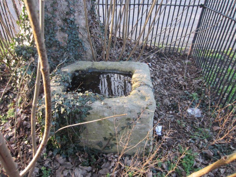
Socket stone of medieval wayside cross. Possibly C12. Grey ashlar limestone. Rectangular plan, approximately 600 millimetres by 500 millimetres and about 350 millimetres high, with a large square socket in the top side. On each side are three round-topped recessed panels, forming an arcade, the spacing closer on the narrower sides. The stone lies within a railed enclosure, with a canted ashlar coping supporting early-C20 circular wrought-iron bars, bent outwards at the top, with mid and top rails, and spear finials to corner standards. Inside the enclosure a tree and saplings are growing. The cross base lies on the boundary of the Borough of Pontefract, at the junction of an ancient boundary lane with a main road. In Pontefract Museum (qv) are two fragments of the cross shaft, one formerly in Darrington Church and the other in a barn at Bubwith Farm; one shows a figure on a horse, the other a seated figure.
Listing NGR: SE4694323453
External links are from the relevant listing authority and, where applicable, Wikidata. Wikidata IDs may be related buildings as well as this specific building. If you want to add or update a link, you will need to do so by editing the Wikidata entry.


Other nearby listed buildings
