Latitude: 50.2162 / 50°12'58"N
Longitude: -5.4774 / 5°28'38"W
OS Eastings: 152020
OS Northings: 40925
OS Grid: SW520409
Mapcode National: GBR DXV3.HV7
Mapcode Global: VH12F.0TNL
Plus Code: 9C2P6G8F+F2
Entry Name: 1-13, Carncrows Street
Listing Date: 22 December 1972
Grade: II
Source: Historic England
Source ID: 1136752
English Heritage Legacy ID: 68946
ID on this website: 101136752
Location: St Ives, Cornwall, TR26
County: Cornwall
Civil Parish: St. Ives
Built-Up Area: St Ives
Traditional County: Cornwall
Lieutenancy Area (Ceremonial County): Cornwall
Church of England Parish: St Ives
Church of England Diocese: Truro
Tagged with: Building
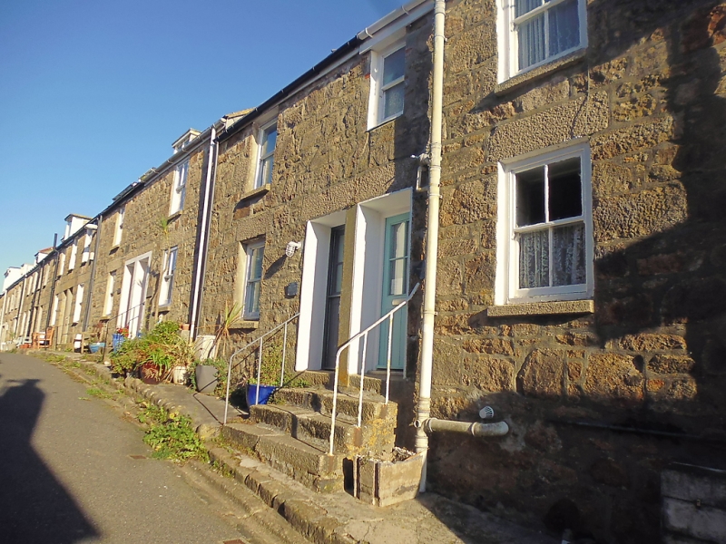
CARNCROWS STREET
1. ----------------
1587 Nos 1 to 13 (consec)
SW 54 SW 1/47
II GV
2.
C18/19 terrace of cottages. Granite rubble. Two Storeys, two windows
each. Slate roofs, sashes, no glazing bars, Steps to first floor doors.
Some modern dormers. Gproup value.
Nos 1 to 13 (consec) form a group.
Listing NGR: SW5202040925
External links are from the relevant listing authority and, where applicable, Wikidata. Wikidata IDs may be related buildings as well as this specific building. If you want to add or update a link, you will need to do so by editing the Wikidata entry.


Other nearby listed buildings