Approximate Location Map
Large Map »
Latitude: 54.2875 / 54°17'15"N
Longitude: -2.7474 / 2°44'50"W
OS Eastings: 351440
OS Northings: 488243
OS Grid: SD514882
Mapcode National: GBR 9L7V.ZT
Mapcode Global: WH832.RHWH
Plus Code: 9C6V77P3+X2
Entry Name: Larkrigg Hall Bridge over Lancaster/Kendal Canal
Listing Date: 22 November 1983
Grade: II
Source: Historic England
Source ID: 1136839
English Heritage Legacy ID: 75285
ID on this website: 101136839
Location: Westmorland and Furness, Cumbria, LA9
County: Cumbria
District: South Lakeland
Civil Parish: Helsington
Traditional County: Westmorland
Lieutenancy Area (Ceremonial County): Cumbria
Church of England Parish: Underbarrow with Helsington
Church of England Diocese: Carlisle
Tagged with: Bridge
SD 58 NW
HELSINGTON
4/12
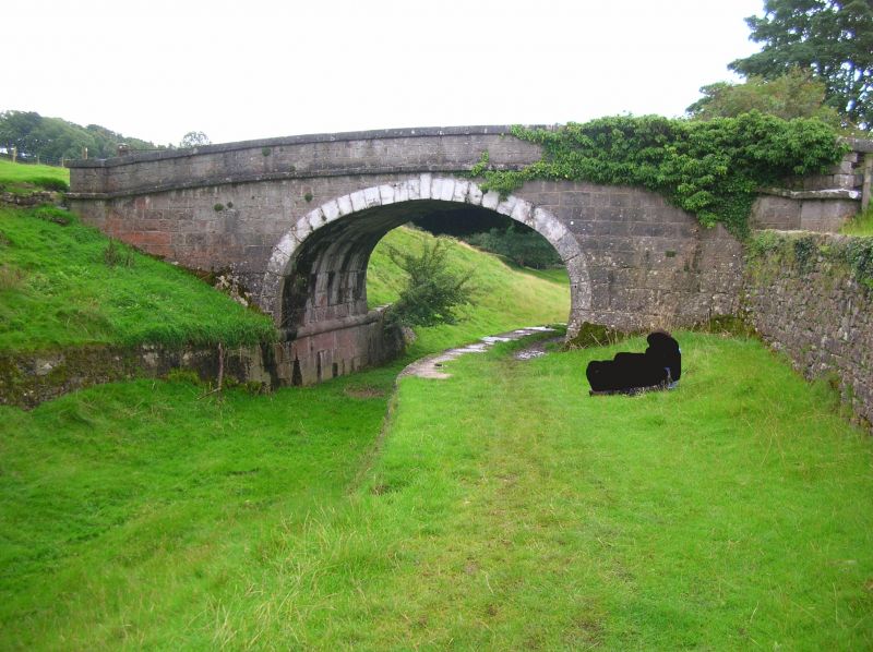
Larkrigg Hall Bridge
over Lancaster/Kendal
Canal
II
Canal Bridge. Canal opened in 1819. Engineer John Rennie. Local limestone
ashlar. Single 3-centred arch. Slightly arched parapets with overhanging
copings and bands. Canal now dry.
Listing NGR: SD5144088243
External links are from the relevant listing authority and, where applicable, Wikidata. Wikidata IDs may be related buildings as well as this specific building. If you want to add or update a link, you will need to do so by editing the Wikidata entry.


Other nearby listed buildings
