Latitude: 53.3815 / 53°22'53"N
Longitude: -2.5694 / 2°34'9"W
OS Eastings: 362219
OS Northings: 387330
OS Grid: SJ622873
Mapcode National: GBR BYHB.JK
Mapcode Global: WH98R.H8PJ
Plus Code: 9C5V9CJJ+H6
Entry Name: 562-568, Knutsford Road
Listing Date: 4 April 1975
Grade: II
Source: Historic England
Source ID: 1139393
English Heritage Legacy ID: 58810
ID on this website: 101139393
Location: Latchford, Warrington, Cheshire, WA4
County: Warrington
Electoral Ward/Division: Latchford East
Parish: Non Civil Parish
Built-Up Area: Warrington
Traditional County: Cheshire
Lieutenancy Area (Ceremonial County): Cheshire
Church of England Parish: Latchford Christ Church
Church of England Diocese: Chester
Tagged with: Building
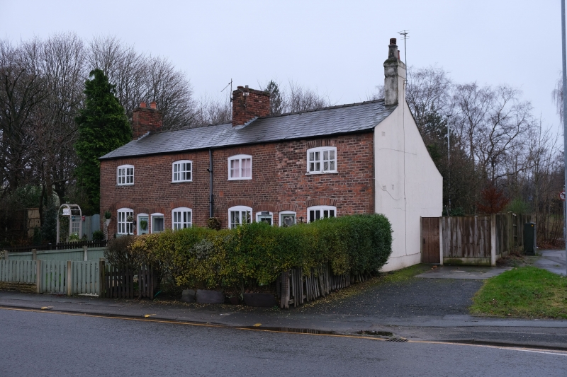
1. KNUTSFORD ROAD
5150
Nos 562 to 568 (even)
SJ 68 NW 4/86
II
2.
Small terrace of cottages, late C18, old brick, slate roof, 2 low storeys. Each
has plain door and one window on each floor, all segmental headed with 2-light
casements.
Listing NGR: SJ6221987330
External links are from the relevant listing authority and, where applicable, Wikidata. Wikidata IDs may be related buildings as well as this specific building. If you want to add or update a link, you will need to do so by editing the Wikidata entry.


Other nearby listed buildings