Latitude: 53.3812 / 53°22'52"N
Longitude: -2.5661 / 2°33'57"W
OS Eastings: 362443
OS Northings: 387298
OS Grid: SJ624872
Mapcode National: GBR BYJB.7N
Mapcode Global: WH98R.K89R
Plus Code: 9C5V9CJM+FH
Entry Name: The Chesire Cheese Public House
Listing Date: 4 April 1975
Grade: II
Source: Historic England
Source ID: 1139394
English Heritage Legacy ID: 58811
ID on this website: 101139394
Location: Latchford, Warrington, Cheshire, WA4
County: Warrington
Electoral Ward/Division: Latchford East
Parish: Non Civil Parish
Built-Up Area: Warrington
Traditional County: Cheshire
Lieutenancy Area (Ceremonial County): Cheshire
Church of England Parish: Latchford Christ Church
Church of England Diocese: Chester
Tagged with: Pub
This list entry was subject to a Minor Amendment on 13 April 2026 to correct a typo in the name and address and reformat text to current standards
SJ 68 NW
4/87
KNUTSFORD ROAD
No 654
(The Cheshire Cheese Public House)
II
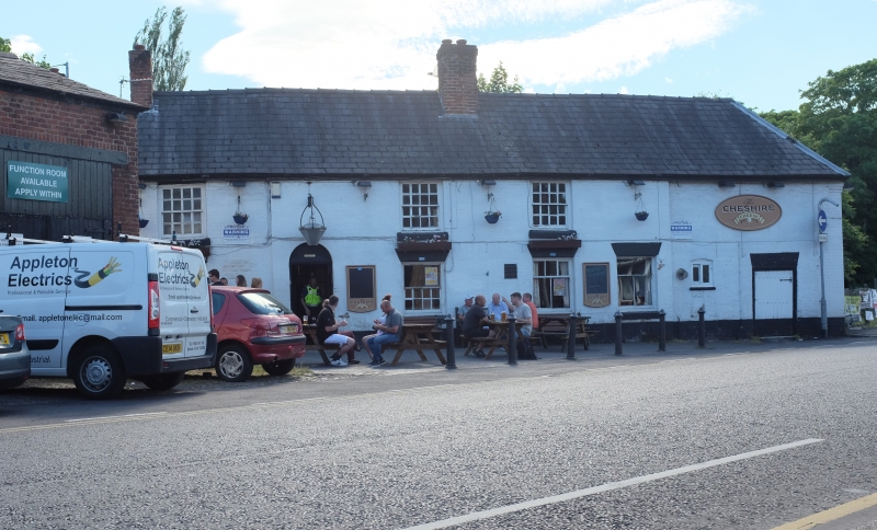
Public house, former stables etc in L plan, probably late C18, white painted brick, slate roof, two storeys, low proportions. Round-arched doorway with boarded door and iron trim, four sash windows on ground floor (one nine-paned, one 12-paned, and two new), and three 12-paned sashes above. Small stable door and tiny window to right under same roof. Wing set back at angle, retains horizontal sliding sashes.
Listing NGR: SJ6244387298
External links are from the relevant listing authority and, where applicable, Wikidata. Wikidata IDs may be related buildings as well as this specific building. If you want to add or update a link, you will need to do so by editing the Wikidata entry.


Other nearby listed buildings