Latitude: 53.3463 / 53°20'46"N
Longitude: -2.4547 / 2°27'16"W
OS Eastings: 369826
OS Northings: 383364
OS Grid: SJ698833
Mapcode National: GBR CY9R.C5
Mapcode Global: WH990.84BZ
Plus Code: 9C5V8GWW+G4
Entry Name: Dairy Farm House
Listing Date: 5 March 1959
Grade: II
Source: Historic England
Source ID: 1139515
English Heritage Legacy ID: 58529
ID on this website: 101139515
Location: High Legh, Cheshire East, Cheshire, WA16
County: Cheshire East
Civil Parish: High Legh
Traditional County: Cheshire
Lieutenancy Area (Ceremonial County): Cheshire
Church of England Parish: High Legh St John
Church of England Diocese: Chester
Tagged with: Farmhouse
SJ 68 SE HIGH LEGH C.P. HALLIWELL'S BROW
3/36 Dairy Farm House
5.3.59 - II
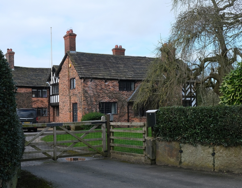
Farmhouse. Late C16/Early C17. Timber frame with rendered infill and English garden wall bond brick and stone slate roof. 2 storeys, H-plan. Garden front: Stone plinth, 14 x 3 cells of small framing to central portion, ground floor window of 3 x 4 casement lights. One first floor window of 3 lights. Gabled wings to either side, each having 4-light ground and first floor windows and panels of Chevron strutting, both coved below gables, that to left having Chevron strutting to gable panels, that to right being V-strutted Interior: Ovolo-moulded beams to ground-floor rooms. Heavily moulded bressumer to parlour fireplace with moulded stone supports to either side. One exposed truss with heavy principals and chamfered cambered tie supported on chamfered wall posts.
Listing NGR: SJ6982683364
External links are from the relevant listing authority and, where applicable, Wikidata. Wikidata IDs may be related buildings as well as this specific building. If you want to add or update a link, you will need to do so by editing the Wikidata entry.


Other nearby listed buildings