Latitude: 52.245 / 52°14'42"N
Longitude: 0.7156 / 0°42'56"E
OS Eastings: 585490
OS Northings: 264234
OS Grid: TL854642
Mapcode National: GBR QF0.7Q3
Mapcode Global: VHKD4.CT4V
Plus Code: 9F426PW8+26
Entry Name: Scandinavia House
Listing Date: 7 August 1952
Last Amended: 30 October 1997
Grade: II
Source: Historic England
Source ID: 1141155
English Heritage Legacy ID: 466624
ID on this website: 101141155
Location: Bury St Edmunds, West Suffolk, IP33
County: Suffolk
District: West Suffolk
Civil Parish: Bury St Edmunds
Built-Up Area: Bury St Edmunds
Traditional County: Suffolk
Lieutenancy Area (Ceremonial County): Suffolk
Church of England Parish: Bury St Edmunds St John the Evangelist
Church of England Diocese: St.Edmundsbury and Ipswich
Tagged with: House
BURY ST EDMUNDS
TL8564SW ANGEL HILL 639-1/14/163 (West side) 07/08/52 No.5 Scandinavia House (Formerly Listed as: ABBEYGATE STREET (North side) Nos.30 AND 30A) (Formerly Listed as: ANGEL HILL (West side) No.5)
GV II
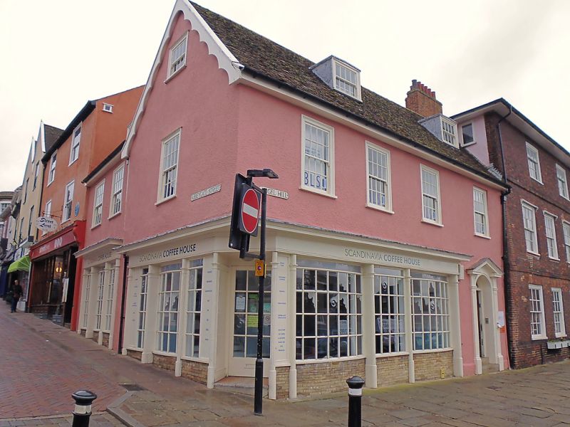
Shop with offices above; formerly shop and house. Early C17 with mainly C20 exterior in Georgian style. Timber-framed and rendered; plaintile roof. EXTERIOR: 2 storeys with attic and cellar. The main range has 4 small-paned sash windows in cased frames to the upper storey and 2 flat-headed dormers with lead cheeks. The slightly projecting gable facing Abbeygate Street has C19 shaped bargeboards, one small-paned sash window to the upper storey and an attic window. A wing extending up Abbeygate Street has 2 similar sash windows to the upper storey and 2 dormers. This was formerly a separate property, No.30 Abbeygate Street, of 3 storeys and attics. Its present form is the result of extensive alterations in the late 1960s, when the ground storey of both ranges had shop fronts in Regency style inserted. INTERIOR: nothing is visible in the former No.30 Abbeygate Street. The range facing Angel Hill is in 5 bays, with all partitions removed on the ground storey. On the upper storey the bay at the south end has the framing exposed: widely spaced studs with short straight tension braces to the gable end; jowled main posts; a main beam with a small chamfer and scroll stops is probably a replacement. A scarf joint in the wallplate with a very short splay. Roof structure hidden.
Listing NGR: TL8548864233
External links are from the relevant listing authority and, where applicable, Wikidata. Wikidata IDs may be related buildings as well as this specific building. If you want to add or update a link, you will need to do so by editing the Wikidata entry.


Other nearby listed buildings