Latitude: 52.2459 / 52°14'45"N
Longitude: 0.7166 / 0°42'59"E
OS Eastings: 585555
OS Northings: 264336
OS Grid: TL855643
Mapcode National: GBR QF0.20Y
Mapcode Global: VHKD4.CTP4
Plus Code: 9F426PW8+9J
Entry Name: 16, Angel Hill
Listing Date: 7 August 1952
Last Amended: 30 October 1997
Grade: II
Source: Historic England
Source ID: 1141164
English Heritage Legacy ID: 466633
ID on this website: 101141164
Location: Bury St Edmunds, West Suffolk, IP33
County: Suffolk
District: West Suffolk
Civil Parish: Bury St Edmunds
Built-Up Area: Bury St Edmunds
Traditional County: Suffolk
Lieutenancy Area (Ceremonial County): Suffolk
Church of England Parish: Bury St Edmunds St John the Evangelist
Church of England Diocese: St.Edmundsbury and Ipswich
Tagged with: Building
BURY ST EDMUNDS
TL8564SE ANGEL HILL 639-1/8/172 (North side) 07/08/52 No.16 (Formerly Listed as: ANGEL HILL No.16 Elcoats House)
GV II
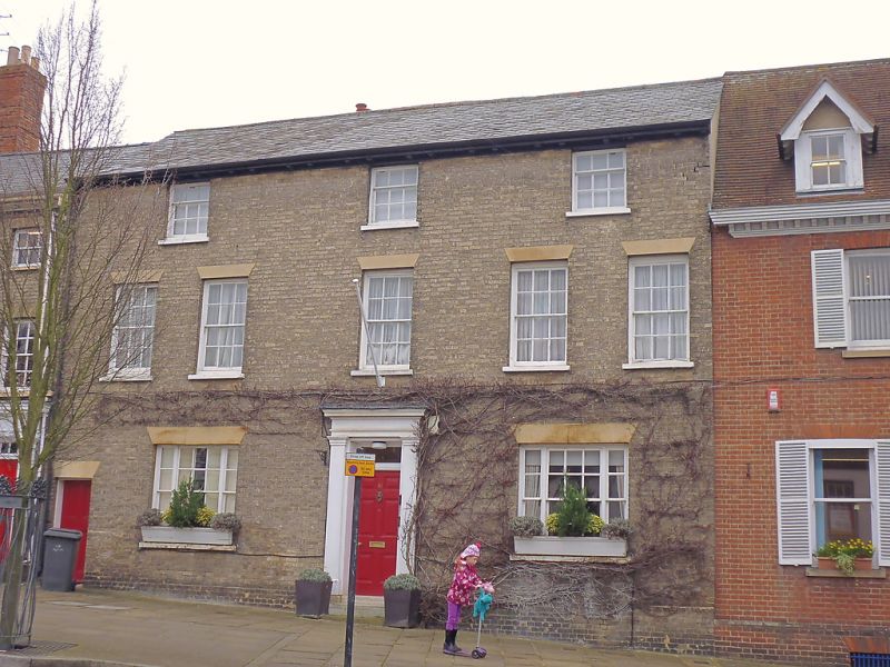
House, now offices. Early C19 front, C16 and C17 core. Timber-framed interior, faced in white brick; slate roof with paired bracketed eaves cornice. EXTERIOR: 3 storeys and cellars; a front range with a rear wing at right-angles and later extensions. 5 windows to the 1st storey, 12-pane sashes in plain reveals with cement flat arches and stone sills; 2 tripartite windows to the ground storey, 12-pane sashes with diminished side-lights, cement heads and stone sills; three 9-pane sashes to the top storey. The central entrance door, up 2 steps, has 6 raised fielded panels, a rectangular fanlight and a doorcase with plain pilasters and cornice. INTERIOR: with some main beams and posts of the timber frame exposed. 2 cellars: on the east side, a C19 cellar which extends below the road; on the west, a C17 cellar below the rear wing. This has an arch-braced tie-beam supporting the ceiling, and one wall, which has the remains of a former bake-oven, is of re-used stone blocks, including part of a large column. Timber remains above the stonework seem to be fragments of a pre-C16 building. The rear wing, on a different level from the front, has had its roof replaced by a single pitch which runs into the rear slope of the main roof. In its end wall a cambered tie-beam, chamfered and stopped, implies that the wing was initially longer. An edge-halved and bridled scarf in one wallplate. On the top storey the rear wallplate of the front range is exposed, and one collar-beam indicates the roof-slope of the original attic, raised to a full storey in the early C19 when the house was refronted. A small C20 rear extension incorporates a sash window of c1700 with heavy ovolo-moulded glazing-bars.
Listing NGR: TL8555564336
External links are from the relevant listing authority and, where applicable, Wikidata. Wikidata IDs may be related buildings as well as this specific building. If you want to add or update a link, you will need to do so by editing the Wikidata entry.


Other nearby listed buildings