Latitude: 50.2194 / 50°13'9"N
Longitude: -5.2741 / 5°16'26"W
OS Eastings: 166536
OS Northings: 40621
OS Grid: SW665406
Mapcode National: GBR Z0.S9N9
Mapcode Global: VH12J.JRN5
Plus Code: 9C2P6P9G+Q9
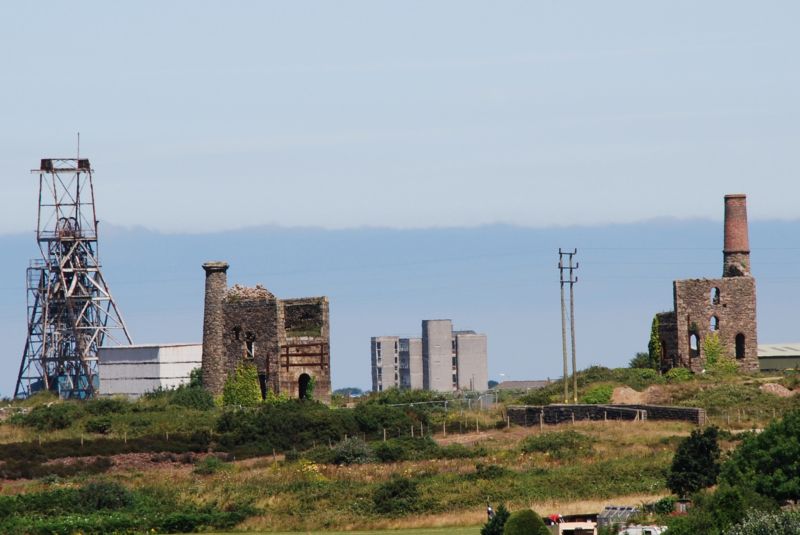
Entry Name: Winding Engine House to Chappel's Shaft of Old Cook's Kitchen Mine at SW 665 406
Listing Date: 12 September 1989
Grade: II
Source: Historic England
Source ID: 1142629
English Heritage Legacy ID: 66720
ID on this website: 101142629
Location: Brea, Cornwall, TR15
County: Cornwall
Civil Parish: Carn Brea
Built-Up Area: Camborne
Traditional County: Cornwall
Lieutenancy Area (Ceremonial County): Cornwall
Church of England Parish: Camborne and Tuckinghill
Church of England Diocese: Truro
Tagged with: Chimney Engine house
CARN BREA TINCROFT ROAD SW 64 SE (north side, off) 5/164 Winding engine house to Chappel's shaft of Old Cook's Kitchen Mine at SW 665 406 GV II
Winding engine house (or "whim") to former copper and tin mine; now derelict and dilapidated. Probably early to mid C19. Uncoursed granite rubble with quoins, bob wall of dressed granite blocks, brick arches to windows and brick upper stage to chimney; now roofless. Rectangular plan on east-west axis, with bob wall to west, remains of foundations of former winding drum in front of this, chimney attached at north-east corner. Three stages, with round-headed openings including driver's window in bob wall, with brick surround, 2 windows at ground floor of south wall and one on each floor above, and one window on each floor of rear wall; north side wall collapsed. Tapered cylindrical chimney stack with cornices to both stages. History: Cook's Kitchen Mine was one of the earliest mines in the area, known to have been working for copper in early C18, and also one of the deepest (reaching 3000 feet), and most profitable; closed in 1913. Reference: J.Trounson Mining in Cornwall Volume One (1985). Forms prominent group with pump engine and chimney to the west (q.v.).
Listing NGR: SW6650040600
External links are from the relevant listing authority and, where applicable, Wikidata. Wikidata IDs may be related buildings as well as this specific building. If you want to add or update a link, you will need to do so by editing the Wikidata entry.


Other nearby listed buildings