Latitude: 50.2203 / 50°13'13"N
Longitude: -5.2689 / 5°16'8"W
OS Eastings: 166910
OS Northings: 40705
OS Grid: SW669407
Mapcode National: GBR Z0.SC07
Mapcode Global: VH12J.MQDG
Plus Code: 9C2P6PCJ+4C
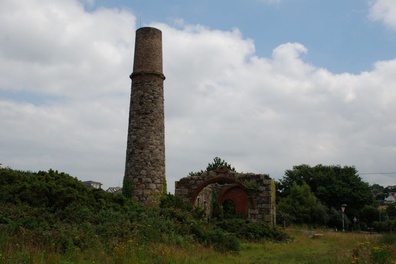
Entry Name: Compressor House and Chimney Approximately 45 Metres East of Tincroft Mine Man Engine
Listing Date: 7 April 1983
Grade: II
Source: Historic England
Source ID: 1328163
English Heritage Legacy ID: 66722
ID on this website: 101328163
Location: Penhallick, Cornwall, TR15
County: Cornwall
Civil Parish: Carn Brea
Built-Up Area: Camborne
Traditional County: Cornwall
Lieutenancy Area (Ceremonial County): Cornwall
Church of England Parish: Camborne and Tuckinghill
Church of England Diocese: Truro
Tagged with: Architectural structure
CARN BREA TINCROFT ROAD SW 64 SE (north side) 5/166 Compressor house and chimney 7.4.83 approx. 45 metres east of Tincroft Mine Man Engine
GV II Compressor house and chimney to former man engine of former tin mine; now derelict. Late C19. Granite rubble with squared quoins and jambs, brick arches to openings; now roofless. Rectangular plan on east-west axis. Single storey; west front (towards shaft) has very wide round-headed doorway or machine way; south side wall has 3 round-headed windows, that in the centre larger and higher than the others, and rear has 2 similar windows, both these walls now heavily ivy- clad. Attached to north-west corner by short wall is tapered cylindrical chimney with prominent moulded brick cornice to the stone stage, top of brick stage damaged. Interior: 2 rows of large squared machine bases separated by a narrow slot for a reciprocating beam. History: although incomplete, a substantial survival of the man engine which operated from 1863 to 1894, and believed to be the only extant example not ruined. In 1870 Tincroft Mine was reported to be the richest tin mine in the world; it ceased underground operations in 1926. The item forms a group with its functional partner, the man engine house approx. 45 metres to the west (q.v.).
Listing NGR: SW6691040705
External links are from the relevant listing authority and, where applicable, Wikidata. Wikidata IDs may be related buildings as well as this specific building. If you want to add or update a link, you will need to do so by editing the Wikidata entry.


Other nearby listed buildings