Latitude: 50.2098 / 50°12'35"N
Longitude: -5.4784 / 5°28'42"W
OS Eastings: 151915
OS Northings: 40216
OS Grid: SW519402
Mapcode National: GBR DXV4.3CH
Mapcode Global: VH12F.0Z4J
Plus Code: 9C2P6G5C+WJ
Entry Name: 27, the Terrace
Listing Date: 22 December 1972
Grade: II
Source: Historic England
Source ID: 1143305
English Heritage Legacy ID: 69117
ID on this website: 101143305
Location: St Ives, Cornwall, TR26
County: Cornwall
Civil Parish: St. Ives
Built-Up Area: St Ives
Traditional County: Cornwall
Lieutenancy Area (Ceremonial County): Cornwall
Church of England Parish: St Ives
Church of England Diocese: Truro
Tagged with: Building
THE TERRACE
1. -----------
1587 No 27
SW 54 SW 1/158
II GV
2.
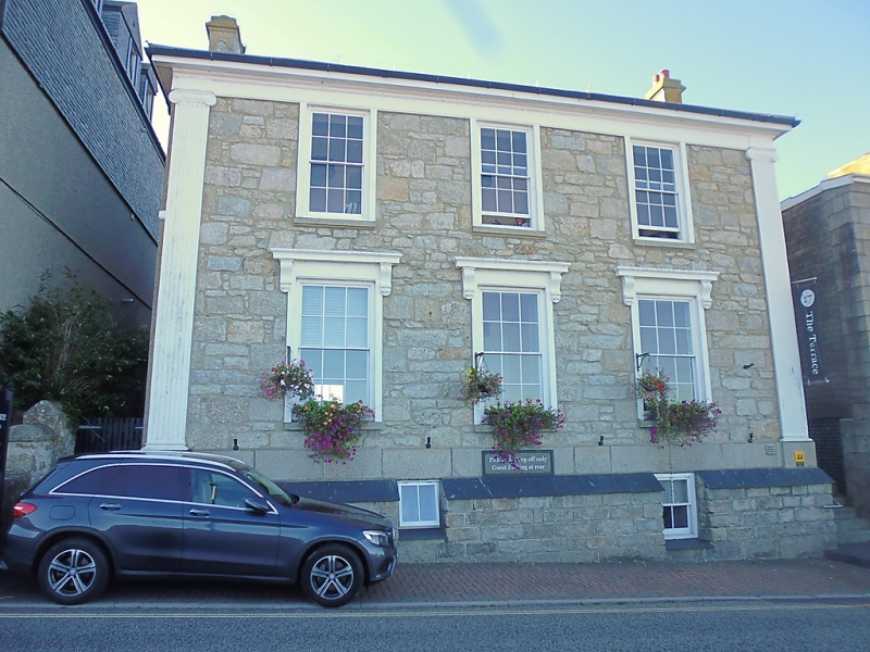
Originally an early C19 stucco house, now roughcast. Two storeys. Three
windows, sashes with glazing bars. Cornices and consoles to ground floor
windows, Fluted Ionic quoin pilasters. One string course. Moulded eaves
course. Slate hipped roof. Side entrance with, fluted ionic columns.
Nos 21 to 27 (consec) form a group.
Listing NGR: SW5191540216
External links are from the relevant listing authority and, where applicable, Wikidata. Wikidata IDs may be related buildings as well as this specific building. If you want to add or update a link, you will need to do so by editing the Wikidata entry.


Other nearby listed buildings