Approximate Location Map
Large Map »
Latitude: 50.2058 / 50°12'20"N
Longitude: -5.4717 / 5°28'18"W
OS Eastings: 152374
OS Northings: 39743
OS Grid: SW523397
Mapcode National: GBR DXW4.DGG
Mapcode Global: VH12M.33P2
Plus Code: 9C2P6G4H+88
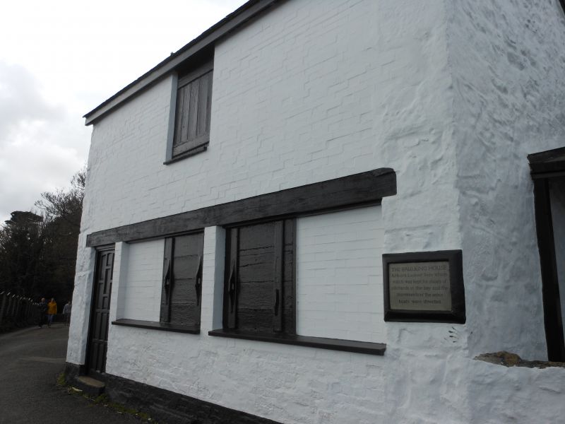
Entry Name: The Baulking House
Listing Date: 4 June 1952
Grade: II
Source: Historic England
Source ID: 1143343
English Heritage Legacy ID: 69012
ID on this website: 101143343
Location: St Ives, Cornwall, TR26
County: Cornwall
Civil Parish: St. Ives
Built-Up Area: St Ives
Traditional County: Cornwall
Lieutenancy Area (Ceremonial County): Cornwall
Church of England Parish: St Ives
Church of England Diocese: Truro
Tagged with: House
HAINWALK
1. --------
1587 The Baulkng House
SW 53 NW 5/271 4.6.52.
II
2.
Probably early C19. Painted rubble stone walled building with brick front,
gabled roof with scantle slating. Two storeys. Two horizontal sliding -
sashes on ground floor with loft door above. Situated high up overlooking
the bay, it was a huer's lookout from which watch was kept for pilchard
shoals and the seine boats were directed.
Listing NGR: SW5237439743
External links are from the relevant listing authority and, where applicable, Wikidata. Wikidata IDs may be related buildings as well as this specific building. If you want to add or update a link, you will need to do so by editing the Wikidata entry.


Other nearby listed buildings
