Latitude: 50.3353 / 50°20'7"N
Longitude: -4.7606 / 4°45'38"W
OS Eastings: 203638
OS Northings: 52024
OS Grid: SX036520
Mapcode National: GBR N1.X6YY
Mapcode Global: FRA 08X4.WP3
Plus Code: 9C2Q86PQ+4Q
Entry Name: 70, Charlestown Road
Listing Date: 11 March 1974
Last Amended: 12 January 1977
Grade: II
Source: Historic England
Source ID: 1144293
English Heritage Legacy ID: 70687
ID on this website: 101144293
Location: Charlestown, Cornwall, PL25
County: Cornwall
Civil Parish: St Austell Bay
Built-Up Area: St Austell
Traditional County: Cornwall
Lieutenancy Area (Ceremonial County): Cornwall
Church of England Parish: Charlestown
Church of England Diocese: Truro
Tagged with: Building
CHARLESTOWN 1. CHARLESTOWN ROAD 1584A (East Side) Nos 68 & 70 SX 05 SW 9/32
II GV
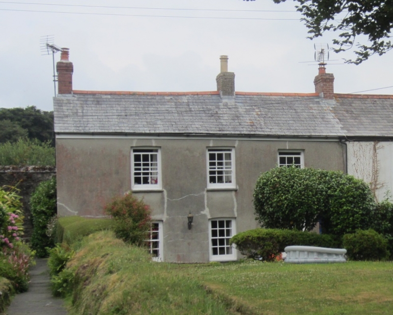
2. Early C19 cottages. Stone rubble partly rendered. 2 storeys. 3 windows overall sashes with glazing bars and brick arches. Glazed doors. Slate roof with gable ends. Included for group value only.
Nos 62 to 82 (even) form a group.
Listing NGR: SX0363852024
External links are from the relevant listing authority and, where applicable, Wikidata. Wikidata IDs may be related buildings as well as this specific building. If you want to add or update a link, you will need to do so by editing the Wikidata entry.


Other nearby listed buildings