Approximate Location Map
Large Map »
Latitude: 50.1298 / 50°7'47"N
Longitude: -5.6283 / 5°37'41"W
OS Eastings: 140793
OS Northings: 31828
OS Grid: SW407318
Mapcode National: GBR DXHB.LRB
Mapcode Global: VH058.DZFW
Plus Code: 9C2P49HC+WM
Entry Name: Guide Post at SW407318
Listing Date: 15 December 1988
Grade: II
Source: Historic England
Source ID: 1158218
English Heritage Legacy ID: 69812
ID on this website: 101158218
Location: Cornwall, TR20
County: Cornwall
Civil Parish: Sancreed
Traditional County: Cornwall
Lieutenancy Area (Ceremonial County): Cornwall
Church of England Parish: Sancreed
Church of England Diocese: Truro
Tagged with: Fingerpost Milestone
SANCREED
SW 43 SW
2/270
- Guide post at SW407318
GV
II
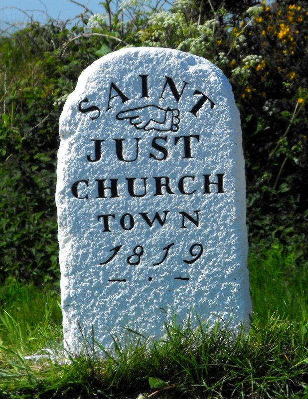
Guide post. Early C19, probably 1819. Dressed granite monolith with pyramidal head
and incised inscriptions to front and rear.
Front inscription: SAINT
over hand pointer JUST
ROAD
and
MORVAH
Rear inscription: SAINT
JUST
TOWN
18-
Listing NGR: SW4079331827
External links are from the relevant listing authority and, where applicable, Wikidata. Wikidata IDs may be related buildings as well as this specific building. If you want to add or update a link, you will need to do so by editing the Wikidata entry.


Other nearby listed buildings
