Latitude: 54.8019 / 54°48'6"N
Longitude: -1.6359 / 1°38'9"W
OS Eastings: 423505
OS Northings: 545287
OS Grid: NZ235452
Mapcode National: GBR KD0X.MF
Mapcode Global: WHC4H.VK6M
Plus Code: 9C6WR927+QM
Entry Name: Snaith Tomb Circa 7 Metres South of Church of St Michael
Listing Date: 14 January 1988
Grade: II
Source: Historic England
Source ID: 1160004
English Heritage Legacy ID: 110045
ID on this website: 101160004
Location: St Michael and All Angels' Church, Witton Gilbert, County Durham, DH7
County: County Durham
Civil Parish: Witton Gilbert
Built-Up Area: Witton Gilbert
Traditional County: Durham
Lieutenancy Area (Ceremonial County): County Durham
Church of England Parish: Witton Gilbert
Church of England Diocese: Durham
Tagged with: Tomb
WITTON GILBERT CHURCH LANE NZ 24 NW (South end) 1/54 (inset) Snaith tomb circa 7 metres south of east end of Church of St. Michael GV II
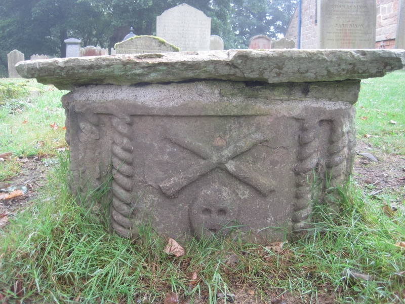
Chest tomb. Probably late C17; to John Snaith and his wife Frances. Sandstone ashlar slab with moulded edge; end supports have double cord-moulded edges and large low-relief skull with cross-bones; sides damaged, leaving only corner cord-moulding. Top partly eroded, with small incised cross at head of long inscription in letters of late C17 or early C18 character.
Listing NGR: NZ2350545287
External links are from the relevant listing authority and, where applicable, Wikidata. Wikidata IDs may be related buildings as well as this specific building. If you want to add or update a link, you will need to do so by editing the Wikidata entry.


Other nearby listed buildings