Latitude: 54.8057 / 54°48'20"N
Longitude: -1.6424 / 1°38'32"W
OS Eastings: 423084
OS Northings: 545704
OS Grid: NZ230457
Mapcode National: GBR JDZW.72
Mapcode Global: WHC4H.RG3R
Plus Code: 9C6WR945+72
Entry Name: Former Smithy to West of No 29
Listing Date: 14 January 1988
Grade: II
Source: Historic England
Source ID: 1323241
English Heritage Legacy ID: 110048
ID on this website: 101323241
Location: Witton Gilbert, County Durham, DH7
County: County Durham
Civil Parish: Witton Gilbert
Built-Up Area: Witton Gilbert
Traditional County: Durham
Lieutenancy Area (Ceremonial County): County Durham
Church of England Parish: Witton Gilbert
Church of England Diocese: Durham
Tagged with: Smithy
WITTON GILBERT FRONT STREET NZ 24 NW (South side) 1/57 Former smithy to west of No. 29 II
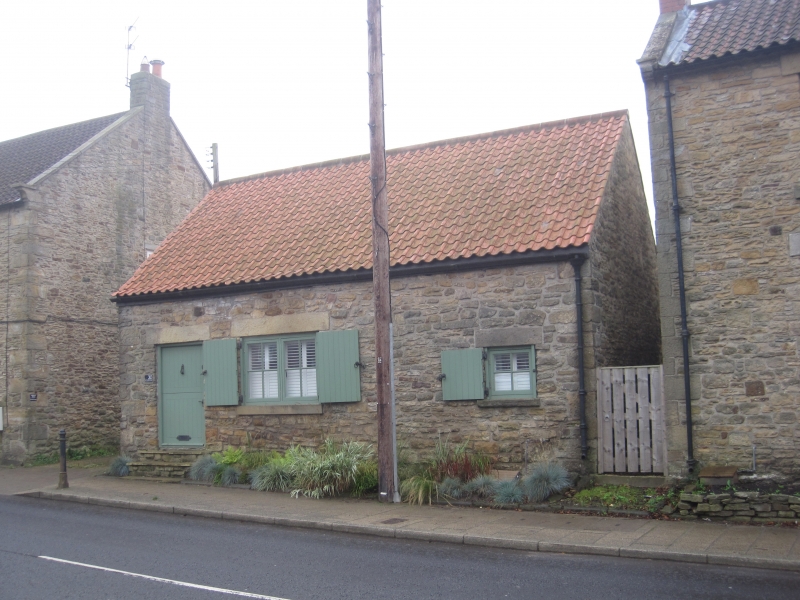
Smithy; present use not known. Probably early C19. Rendered with quoins and ashlar dressings; left return sandstone rubble; pantiled roof. One storey, 3 bays. Boarded Dutch door at left under flat stone lintel; similar lintels over shuttered smithy window at centre and small square window at right, with projecting stone sills. Left return has wood lintel over boarded opening in gable peak. Interior not inspected.
Listing NGR: NZ2308445704
External links are from the relevant listing authority and, where applicable, Wikidata. Wikidata IDs may be related buildings as well as this specific building. If you want to add or update a link, you will need to do so by editing the Wikidata entry.


Other nearby listed buildings