Latitude: 51.6451 / 51°38'42"N
Longitude: -1.0042 / 1°0'15"W
OS Eastings: 468996
OS Northings: 194505
OS Grid: SU689945
Mapcode National: GBR B1Y.YQ4
Mapcode Global: VHDVT.JXY7
Plus Code: 9C3WJXWW+28
Entry Name: 1, Shirburn Street
Listing Date: 11 December 1985
Grade: II
Source: Historic England
Source ID: 1181468
English Heritage Legacy ID: 247690
ID on this website: 101181468
Location: Watlington, South Oxfordshire, OX49
County: Oxfordshire
District: South Oxfordshire
Civil Parish: Watlington
Built-Up Area: Watlington
Traditional County: Oxfordshire
Lieutenancy Area (Ceremonial County): Oxfordshire
Church of England Parish: Watlington
Church of England Diocese: Oxford
Tagged with: Building
WATLINGTON SHIRBURN STREET SU6894, SU6994 (West side) 6/217, 7/217 No.1
GV II
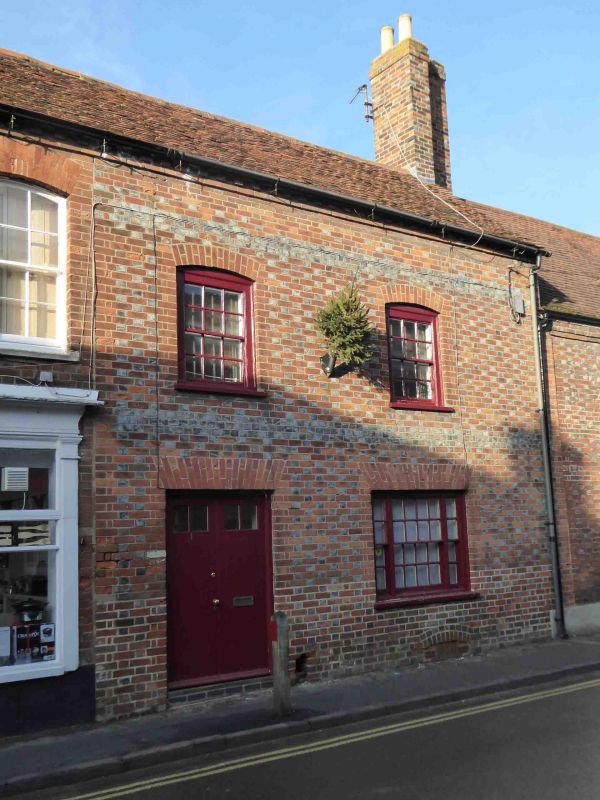
House. Late C16/early C17, refronted late C18. Originally timber-framed. Front of late C18 Flemish brick with flared headers; gabled tile roof; brick and rendered rear stacks. L-plan with rear left wing. 2 storeys; 2-window range. Segmental arched cellar windows. Flat brick arches over double-leaf 4-panelled doors with overlight and tripartite sash to right; segmental arches over first-floor 6-pane sashes. Flared brick storey bands; dentilled eaves. C17 rear wing of 2 storeys; 2-bay range; clad in C18 colourwashed brick and with gabled old tile roof. Interior: quartered chamfered and stopped beans with mid C19 fireplace to right and timber-framed rear wall. First floor has ogee-stopped beam to right and square timber framing with jowled posts to rear: roof not inspected. Closed truss with clasped purlins and wattle and daub infill at junction with rear wing. Included for group value.
Listing NGR: SU6900194508
External links are from the relevant listing authority and, where applicable, Wikidata. Wikidata IDs may be related buildings as well as this specific building. If you want to add or update a link, you will need to do so by editing the Wikidata entry.


Other nearby listed buildings