Latitude: 51.6453 / 51°38'42"N
Longitude: -1.0041 / 1°0'14"W
OS Eastings: 469004
OS Northings: 194520
OS Grid: SU690945
Mapcode National: GBR B1Y.YRC
Mapcode Global: VHDVT.KX04
Plus Code: 9C3WJXWW+49
Entry Name: The Brewery Tap Public House and Attached Stables
Listing Date: 18 July 1963
Last Amended: 11 December 1985
Grade: II
Source: Historic England
Source ID: 1369039
English Heritage Legacy ID: 247689
ID on this website: 101369039
Location: Watlington, South Oxfordshire, OX49
County: Oxfordshire
District: South Oxfordshire
Civil Parish: Watlington
Built-Up Area: Watlington
Traditional County: Oxfordshire
Lieutenancy Area (Ceremonial County): Oxfordshire
Church of England Parish: Watlington
Church of England Diocese: Oxford
Tagged with: Pub
WATLINGTON SHIRBURN STREET SU6894, SU6994 (West side) 6/216, 7/216 No.3 (The Brewery Tap Public 18/07/63 House) and attached stables (Formerly listed as The Brewery Tap) )
GV II
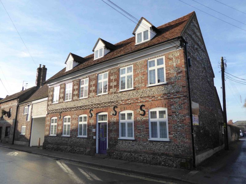
Inn, now public house. Early OS. Front of knapped flint with brick quoins and dressings; brick and rendered rear. Gabled old tile roof; brick rear lateral stacks. 3-unit plan. 2 storeys and attic; 6-window range. Gauged brick cambered arches over C20 door and late C19 door with overlight. Similar ground-floor window arches altered by insertion of late C19 horned sashes. Flat brick arches over first-floor windows, including four C18 cross windows with C20 opening lights. Chequer brick storey band; moulded wood cornice; 3 gabled roof dormers with leaded casements. C18 rear outshuts. Interior: timber-stud partition to left; chamfered bressumer over open fireplace to left. Mostly C20 interior, with probably original roof structure. Subsidiary features: carriageway and 2-storey right angle brewhouse/stable range attached to left: Flemish bond brick with flared headers, gabled old and C20 tile roof, brick left end stack. C19 plank door and 3-light leaded casement to brewhouse left of carriageway: stable range to rear has segmental arches over C20 doors, loft openings and plank loft door, and timber lintel over cartshed entry; queen-post roof with clasped purlins.
Listing NGR: SU6900494520
External links are from the relevant listing authority and, where applicable, Wikidata. Wikidata IDs may be related buildings as well as this specific building. If you want to add or update a link, you will need to do so by editing the Wikidata entry.


Other nearby listed buildings