Latitude: 54.0068 / 54°0'24"N
Longitude: -1.4689 / 1°28'8"W
OS Eastings: 434903
OS Northings: 456880
OS Grid: SE349568
Mapcode National: GBR LQ53.SF
Mapcode Global: WHD9L.DKR6
Plus Code: 9C6W2G4J+PC
Entry Name: Prison Attached to North End of Court House
Listing Date: 12 December 1985
Grade: II
Source: Historic England
Source ID: 1190107
English Heritage Legacy ID: 330756
ID on this website: 101190107
Location: Bebra Gardens, Knaresborough, North Yorkshire, HG5
County: North Yorkshire
District: Harrogate
Civil Parish: Knaresborough
Built-Up Area: Knaresborough
Traditional County: Yorkshire
Lieutenancy Area (Ceremonial County): North Yorkshire
Church of England Parish: Knaresborough
Church of England Diocese: Leeds
Tagged with: Architectural structure
SE 3456 KNARESBOROUGH CASTLE YARD
(south side)
8/93 Prison attached to north
end of Court House (q.v.)
GV II
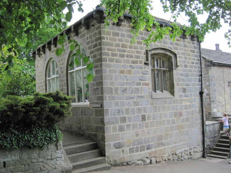
Prison, now veterans club with covered platform. 1786 with medieval
foundations, restored C20. Coursed squared gritstone, stone slate roof.
Single storey, with cells below; 1 bay with glazed platform to right.
Platform on right has 6 steps up to opening in low wall. Main block has 3-
light C18 window with transom and segmental arch under hoodmould. Stone
corbels support guttering. Hipped roof, small flue pipe to rear stack.
Rear: wall of glazed platform on left has blocked flat-arched doorway partly
below ground level. The wall has been raised above lintel height; flat
coping. Right return: entrance to main block is under glazed shelter,
through probably C20 doorway on right. Left return: 2 large round-arched
windows with C20 3-light casements with transom. Interior not inspected.
The building probably contained 2 cells in the mid C19 and was the Castle
Prison for the Forest and Forest Liberty of Knaresborough. Ordnance Survey,
Map of Knaresborough, 5 feet to 1 mile, 1851.
Listing NGR: SE3490356880
External links are from the relevant listing authority and, where applicable, Wikidata. Wikidata IDs may be related buildings as well as this specific building. If you want to add or update a link, you will need to do so by editing the Wikidata entry.


Other nearby listed buildings