Latitude: 53.3265 / 53°19'35"N
Longitude: -1.1756 / 1°10'32"W
OS Eastings: 455004
OS Northings: 381378
OS Grid: SK550813
Mapcode National: GBR NY7Z.88
Mapcode Global: WHDF0.XNC6
Plus Code: 9C5W8RGF+HQ
Entry Name: Railway Bridge Approximately 1075 Metres to East of Brancliffe East Junction
Listing Date: 15 October 1986
Grade: II
Source: Historic England
Source ID: 1192761
English Heritage Legacy ID: 335814
ID on this website: 101192761
Location: Shireoaks, Rotherham, South Yorkshire, S81
County: Rotherham
Civil Parish: North and South Anston
Traditional County: Yorkshire
Lieutenancy Area (Ceremonial County): South Yorkshire
Church of England Parish: Worksop Christ Church and Shireoaks
Church of England Diocese: Southwell and Nottingham
Tagged with: Railway bridge
NORTH AND SOUTH ANSTON CINDER HILL SK58SW/SK58SE SK55008138 5/64, 6/64 Railway bridge approximately 1075 metres to east of Brancliffe East Junction
II
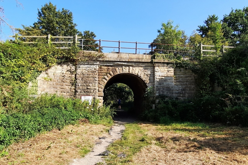
Railway bridge. c1849. For the Manchester, Sheffield and Lincolnshire Railway, engineer John Fowler (James, p.58). Squared, coursed, rock-faced limestone with brick soffit. Single-span bridge accommodating farm-track beneath railway. Ashlar impost band to round arch with voussoirs aligned to courses. Wide flanking buttresses are battered. Rock-faced band and ashlar band with blocking course. Wing walls sweep out to terminate at low end piers. L. James, A Chronology of the Construction of Britain's Railways 1778-1855, 1983.
Listing NGR: SK5500481378
External links are from the relevant listing authority and, where applicable, Wikidata. Wikidata IDs may be related buildings as well as this specific building. If you want to add or update a link, you will need to do so by editing the Wikidata entry.


Other nearby listed buildings