Latitude: 53.3252 / 53°19'30"N
Longitude: -1.1753 / 1°10'31"W
OS Eastings: 455025
OS Northings: 381242
OS Grid: SK550812
Mapcode National: GBR NY7Z.BQ
Mapcode Global: WHDF0.XPH5
Plus Code: 9C5W8RGF+3V
Entry Name: Chesterfield Canal Ryton Aqueduct Approximately 80 Metres to East of Bridge at Cinder Hill
Listing Date: 15 October 1986
Grade: II
Source: Historic England
Source ID: 1286426
English Heritage Legacy ID: 335835
ID on this website: 101286426
Location: Shireoaks, Rotherham, South Yorkshire, S81
County: Rotherham
Civil Parish: Thorpe Salvin
Traditional County: Nottinghamshire
Lieutenancy Area (Ceremonial County): South Yorkshire
Church of England Parish: Thorpe Salvin St Peter
Church of England Diocese: Sheffield
Tagged with: Aqueduct
THORPE SALVIN CHESTERFIELD CANAL SK58SE 6/87 Ryton Aqueduct approximately 80 metres to east of bridge at Cinder Hill
II
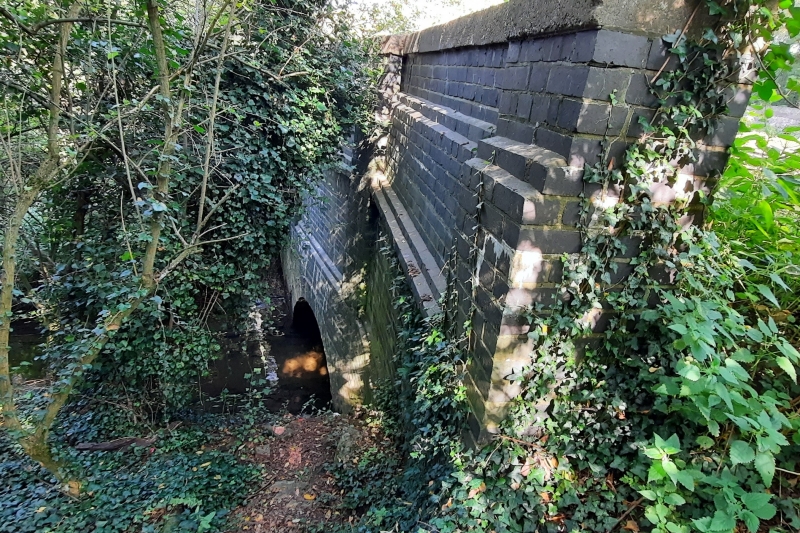
Aqueduct partly in the county of Nottinghamshire. c 1777 partly reconstructed 1946. For the Chesterfield Canal Company, engineer James Brindley. Squared rubble limestone, south side rebuilt in blue brick. Treble-span bridge carrying River Ryton beneath line of canal. North side: 3 segmental arches with chamfered ashlar voussoirs interspersed with unchamfered keyed voussoirs and with projecting keystones; coursed rubblework above reinforced by 3 concrete bands; hammer-dressed, rounded copings to parapet. North wall of aqueduct bears plaque inscribed 'CONSTRUCTED/1772-7/RECONSTRUCTED/1946'; no other details of interest. Important relic of the Chesterfield Canal as engineered by James Brindley and built between 1771 and 1777 under the supervision of John Varley and Hugh Henshall. The Chesterfield Canal, preservation society booklet, 1981.
Listing NGR: SK5502581242
External links are from the relevant listing authority and, where applicable, Wikidata. Wikidata IDs may be related buildings as well as this specific building. If you want to add or update a link, you will need to do so by editing the Wikidata entry.


Other nearby listed buildings