Latitude: 52.6839 / 52°41'1"N
Longitude: -1.8246 / 1°49'28"W
OS Eastings: 411952
OS Northings: 309589
OS Grid: SK119095
Mapcode National: GBR 4DN.MJ5
Mapcode Global: WHCGN.YS9V
Plus Code: 9C4WM5MG+G5
Entry Name: 40, Tamworth Street
Listing Date: 5 February 1952
Grade: II
Source: Historic England
Source ID: 1194904
English Heritage Legacy ID: 382754
ID on this website: 101194904
Location: Lichfield, Staffordshire, WS13
County: Staffordshire
District: Lichfield
Civil Parish: Lichfield
Built-Up Area: Lichfield
Traditional County: Staffordshire
Lieutenancy Area (Ceremonial County): Staffordshire
Church of England Parish: Lichfield St Michael and St Mary
Church of England Diocese: Lichfield
Tagged with: Building
LICHFIELD
SK1109NE TAMWORTH STREET 1094-1/5/186 (South side) 05/02/52 No.40
GV II
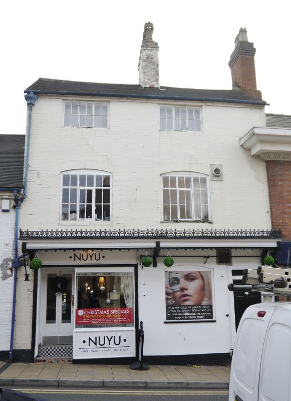
House, at one time a shop. c1760. Painted brick; tile roof with brick cross-axial stack. 3 storeys; 2-window range. Small shop window to left has recessed entrance and plate-glass window with fluted frieze; Entrance to right end has doorcase with moulded pilaster strips and frieze, plain frieze and cornice; 6-panel door. Ground floor window to right of centre has segmental head and 3-light transomed casement; similar windows to 1st floor; 2nd floor has windows with 3-light casements with iron opening casements. Canopy on enriched brackets over ground floor has fascia with pendants and moulded lower edge, cornice with rich cast-iron cresting; right half has bracketed rail beneath. Rainwater head with later downspout.
Listing NGR: SK1195309586
External links are from the relevant listing authority and, where applicable, Wikidata. Wikidata IDs may be related buildings as well as this specific building. If you want to add or update a link, you will need to do so by editing the Wikidata entry.


Other nearby listed buildings