Latitude: 50.0997 / 50°5'58"N
Longitude: -5.2722 / 5°16'20"W
OS Eastings: 166085
OS Northings: 27305
OS Grid: SW660273
Mapcode National: GBR Z1.0XSX
Mapcode Global: VH133.KRNG
Plus Code: 9C2P3PXH+V4
Entry Name: 54, Meneage Street
Listing Date: 9 February 1994
Grade: II
Source: Historic England
Source ID: 1196500
English Heritage Legacy ID: 385525
ID on this website: 101196500
Location: Helston, Cornwall, TR13
County: Cornwall
Civil Parish: Helston
Built-Up Area: Helston
Traditional County: Cornwall
Lieutenancy Area (Ceremonial County): Cornwall
Church of England Parish: Helston
Church of England Diocese: Truro
Tagged with: Building
HELSTON
SW6627 MENEAGE STREET 631-1/5/173 (North East side) No.54
GV II
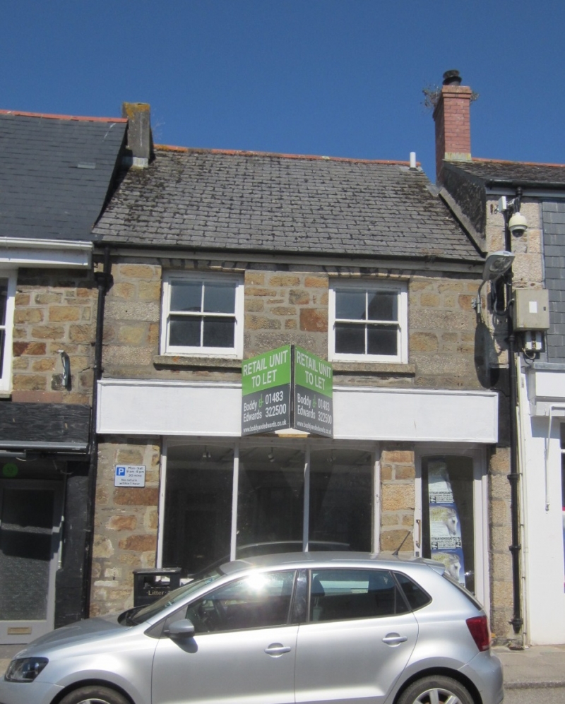
Small town house. Mid C19. Granite rubble with granite dressings; steep asbestos slate roof with rendered stack on left. Double-depth plan. 2 storeys; 2-window range. Flat arches over late C19 four-pane horned sashes. Ground floor has full-width C20 fascia over 3-light mid C20 shop window on the left and C20 door on the right. INTERIOR not inspected. Included for group value.
Listing NGR: SW6608527305
External links are from the relevant listing authority and, where applicable, Wikidata. Wikidata IDs may be related buildings as well as this specific building. If you want to add or update a link, you will need to do so by editing the Wikidata entry.


Other nearby listed buildings