Latitude: 51.643 / 51°38'34"N
Longitude: 0.3359 / 0°20'9"E
OS Eastings: 561722
OS Northings: 196380
OS Grid: TQ617963
Mapcode National: GBR YG.5BK
Mapcode Global: VHHMX.RYXW
Plus Code: 9F32J8VP+59
Entry Name: Milestone in Road Verge Opposite Number 179
Listing Date: 9 December 1994
Grade: II
Source: Historic England
Source ID: 1197192
English Heritage Legacy ID: 373389
ID on this website: 101197192
Location: Brentwood, Essex, CM15
County: Essex
District: Brentwood
Electoral Ward/Division: Shenfield
Parish: Non Civil Parish
Traditional County: Essex
Lieutenancy Area (Ceremonial County): Essex
Church of England Parish: Shenfield St Mary the Virgin
Church of England Diocese: Chelmsford
Tagged with: Milestone
BRENTWOOD
TQ69NW CHELMSFORD ROAD, Shenfield 723-1/6/266 (North West side) Milestone in road verge opposite No.179
II
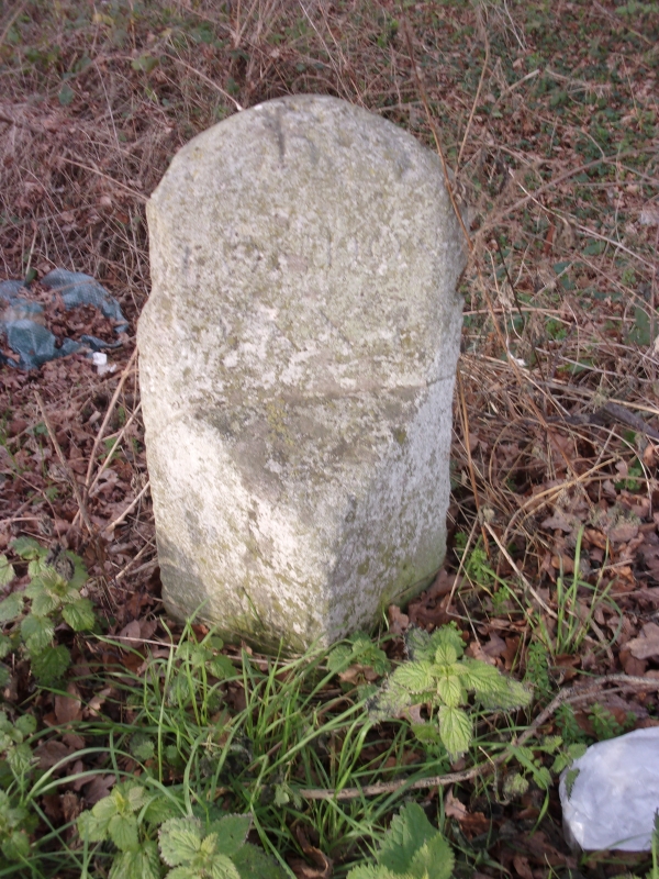
Milestone. C18. Limestone. Square in plan, angled to road, the SE arris chamfered at the top to form an inclined surface inscribed `London XX'. The N face is inscribed `XX miles from London', now facing away from the road. The W face is inscribed with an OS benchmark. Cracked through and cemented about 0.35m from the top. 0.28m square, standing 0.73m above ground. The road between Shenfield and Ingatestone town was one of the first roads in Essex to be turnpiked, by the Essex Trust under an Act of 1695. Cast-iron cover plates were developed in 1819 to reduce the frequent costs of re-cutting the inscriptions, so this is evidently substantially earlier, having been inscribed, turned and inscribed again before 1819. (Booker J: Essex and the Industrial Revolution: 1974-: 101, 105, 113-116; Cary J: Survey of the High Roads from London: 1790-: 47).
Listing NGR: TQ6172296380
External links are from the relevant listing authority and, where applicable, Wikidata. Wikidata IDs may be related buildings as well as this specific building. If you want to add or update a link, you will need to do so by editing the Wikidata entry.


Other nearby listed buildings