Latitude: 50.3517 / 50°21'6"N
Longitude: -3.5803 / 3°34'49"W
OS Eastings: 287667
OS Northings: 51390
OS Grid: SX876513
Mapcode National: GBR QS.R9SW
Mapcode Global: FRA 38D3.F11
Plus Code: 9C2R9C29+MV
Entry Name: The Market Court
Listing Date: 14 September 1949
Last Amended: 23 February 1994
Grade: II
Source: Historic England
Source ID: 1197497
English Heritage Legacy ID: 387287
ID on this website: 101197497
Location: Dartmouth, South Hams, Devon, TQ6
County: Devon
District: South Hams
Civil Parish: Dartmouth
Built-Up Area: Dartmouth
Traditional County: Devon
Lieutenancy Area (Ceremonial County): Devon
Church of England Parish: Dartmouth Townstal
Church of England Diocese: Exeter
Tagged with: Building
DARTMOUTH
SX874510 MARKET SQUARE 673-1/8/167 The Market Court 14/09/49 (Formerly Listed as: MARKET SQUARE Market (including central building))
GV II
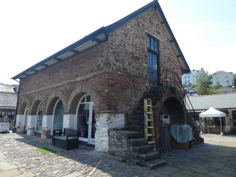
Market Court House, now used as offices. 1828; renovated c1975. Brown-coloured local sandstone rubble with green-grey sandstone rubble detail; axial stack with rendered brick chimneyshaft; slate roof. PLAN: Rectangular building built on a rough east-west axis in the centre of a cobbled yard enclosed by the pannier market buildings (qv). Originally open on the ground floor with the court on the first floor gained by steps up the east end, now enclosed. EXTERIOR: 2 storeys. Ground-floor arcade of 4 bays each side, 2-bay west end and 3-bay east end, all plain round-headed arches with projecting keystones and springing from plain projecting imposts on plain square columns. Projecting band to first-floor level with blind rectangular panels along sides, C20 replacement casement with glazing bars at west end and doorway at east end from double flight of granite steps. Roof is gable-ended with deep eaves carried on shaped brackets. Gables have richly-carved bargeboards with apex pendants. Ground-floor arcade filled mostly with C20 full-height windows but 2 eastern bays on north side blocked with masonry. East-end arcade has central doorway containing panelled double doors under an arch beneath the stairs. Stairs block the outer arches this end and it may be that there was originally an inside stair and the present east-end first-floor doorway, part-glazed double doors with overlight, is secondary. Early painted board fixed to north side prohibiting the leaving of mules on any public highway, market place or slip, by order of the mayor, Daniel Codner, dated 1839. INTERIOR: Plain with no exposed carpentry. HISTORY: Built on land reclaimed from the medieval tidal mill pond, work supervised by the Rev.Charles Holdsworth using family money, the interest to be paid out of borough income. (Freeman, Ray: Dartmouth and its Neighbours: Phillimore: 1990-: P.146).
Listing NGR: SX8766751390
External links are from the relevant listing authority and, where applicable, Wikidata. Wikidata IDs may be related buildings as well as this specific building. If you want to add or update a link, you will need to do so by editing the Wikidata entry.


Other nearby listed buildings