Latitude: 53.7434 / 53°44'36"N
Longitude: -0.3354 / 0°20'7"W
OS Eastings: 509877
OS Northings: 428737
OS Grid: TA098287
Mapcode National: GBR GNP.SH
Mapcode Global: WHGFR.T5GJ
Plus Code: 9C5XPMV7+9R
Entry Name: 9, Parliament Street
Listing Date: 13 October 1952
Grade: II
Source: Historic England
Source ID: 1197707
English Heritage Legacy ID: 387709
ID on this website: 101197707
Location: Kingston upon Hull, East Riding of Yorkshire, HU1
County: City of Kingston upon Hull
Electoral Ward/Division: Myton
Parish: Non Civil Parish
Built-Up Area: Kingston upon Hull
Traditional County: Yorkshire
Lieutenancy Area (Ceremonial County): East Riding of Yorkshire
Church of England Parish: Hull Most Holy and Undivided Trinity
Church of England Diocese: York
Tagged with: Building
KINGSTON UPON HULL
TA0928NE PARLIAMENT STREET 680-1/22/283 (East side) 13/10/52 No.9
GV II
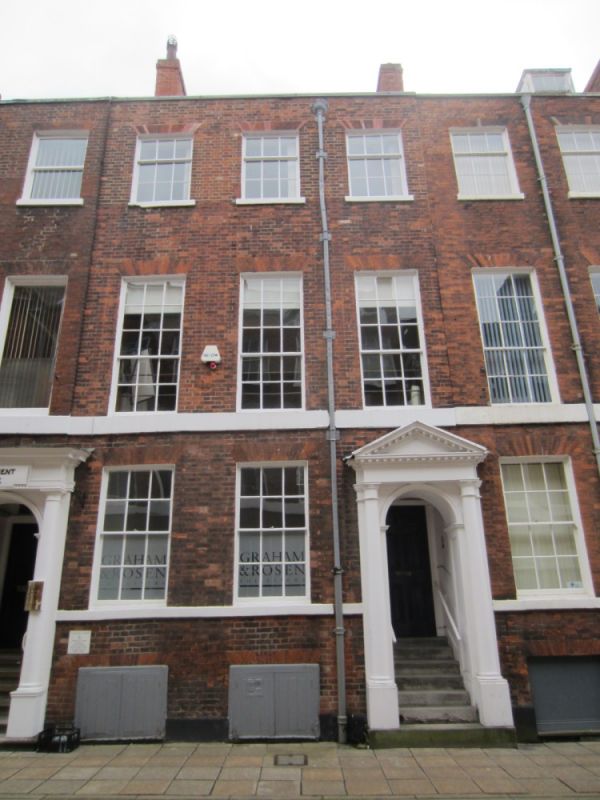
House, now offices. c1797. Brick with painted ashlar dressings and slate roof with a gable stack. Plinth, ground floor and first-floor sill bands, slab-coped parapet. Lead rainwater pipe with fluted head. Windows have brick flat arches. 3 storeys plus basement; 3-window range of 15-pane sashes and above, three 9-pane sashes. Ground floor has to right a wooden coorcase with Doric 3/4 columns and dentillated pediment. Steps to fielded 6-panel door with fanlight. To left, two 12-pane sashes. Below them, 2 pairs of close boarded doors to the basement, with brick flat arches. (Buildings of England: Pevsner N: Yorkshire; York and The East Riding: London: 1972-: 278; Hall, I & E: A New Picture of Georgian Hull: York: 1978-: 17,80,81,97-100).
Listing NGR: TA0987728737
External links are from the relevant listing authority and, where applicable, Wikidata. Wikidata IDs may be related buildings as well as this specific building. If you want to add or update a link, you will need to do so by editing the Wikidata entry.


Other nearby listed buildings